ملف:Harris County Texas incorporated and unincorporated areas South Houston highlighted.svg

حجم معاينة PNG لذلك الملف ذي الامتداد SVG: 449 × 599 بكسل. البعد الآخر: 1٬535 × 2٬048 بكسل.
الملف الأصلي (ملف SVG، أبعاده 587 × 783 بكسل، حجم الملف: 340 كيلوبايت)
وصف قصير
| ⧼wm-license-information-description⧽ |
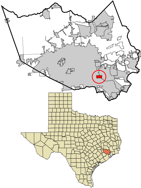
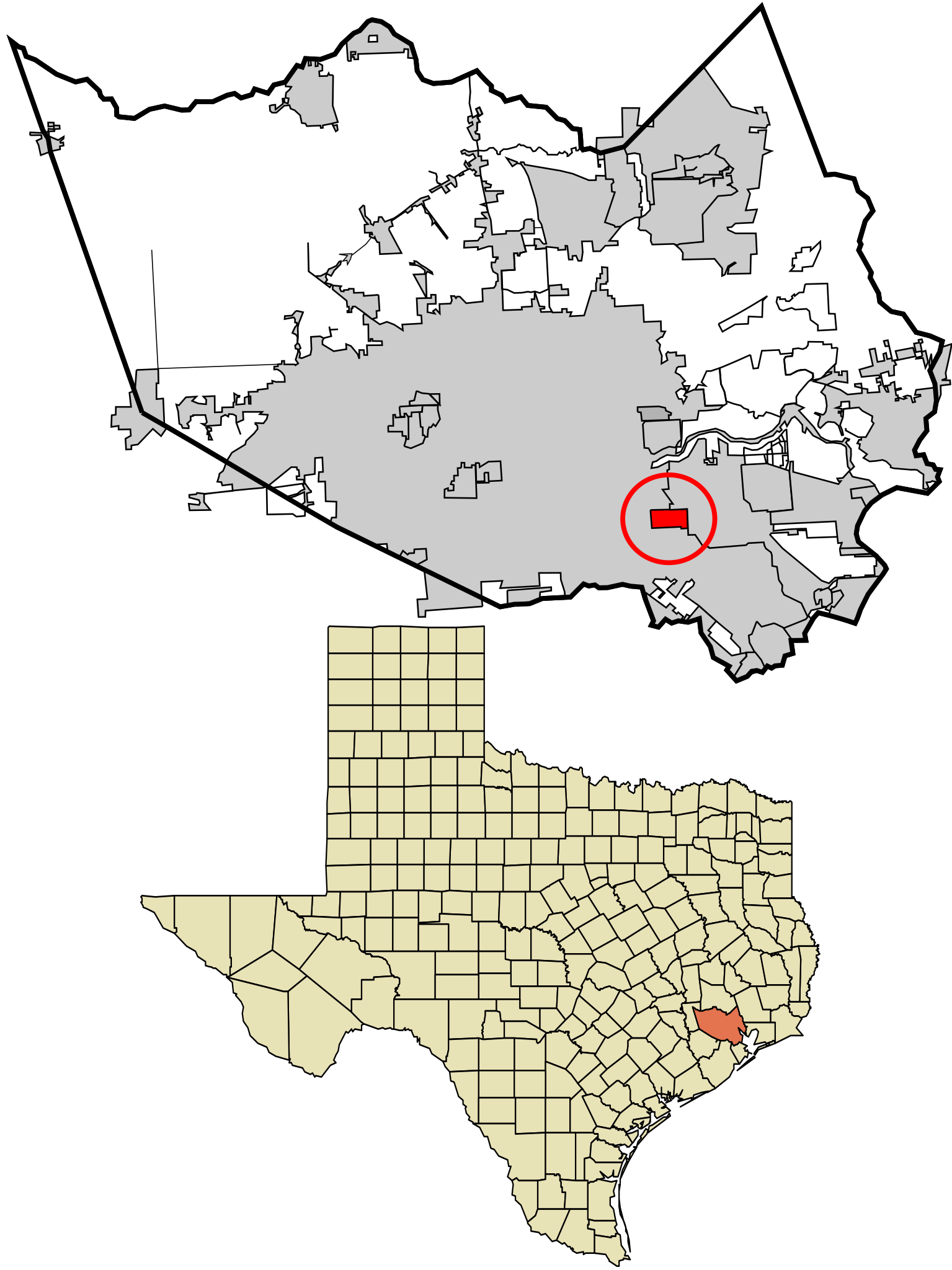
English: Map showing the location of this city within Harris County, Texas. Data source: 2010 U.S. census
|
| ⧼wm-license-information-date⧽ | 2017 |
| ⧼wm-license-information-source⧽ | ⧼Wm-license-own-work⧽ |
| ⧼wm-license-information-author⧽ | Rcsprinter123 |
ترخيص
تاريخ الملف
اضغط على زمن/تاريخ لرؤية الملف كما بدا في هذا الزمن.
| زمن/تاريخ | صورة مصغرة | الأبعاد | مستخدم | تعليق | |
|---|---|---|---|---|---|
| حالي | ★ مراجعة معتمدة 22:09، 1 نوفمبر 2023 | | 587 × 783 (340 كيلوبايت) | Pastakhov (نقاش | مساهمات) | Upload https://upload.wikimedia.org/wikipedia/commons/4/4a/Harris_County_Texas_incorporated_and_unincorporated_areas_South_Houston_highlighted.svg |
لا يمكنك استبدال هذا الملف.
وصلات
لا يوجد صفحات تصل لهذه الصورة.