ملف:HRR 1648 Hst Lübeck.png
حجم هذه المعاينة: 666 × 599 بكسل. البعد الآخر: 681 × 613 بكسل.
الملف الأصلي (681 × 613 بكسل حجم الملف: 226 كيلوبايت، نوع MIME: image/png)
وصف قصير
| ⧼wm-license-information-description⧽ |
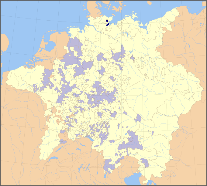
English: Map of the Holy Roman Empire, 1648, with the territories belonging to the prince-bishop of Lübeck highlighted
Deutsch: Karte des Hochstiftes Lübeck im Heiligen Römischen Reich (1648)
|
| ⧼wm-license-information-date⧽ | |
| ⧼wm-license-information-source⧽ | modified from File:Holy Roman Empire 1648 Ecclesiastical.png using information from Putzger Historischer Weltatlas (103rd ed., 2005) |
| ⧼wm-license-information-author⧽ | Roke (map), Hanno Sandvik (addition of colours) |
| ⧼wm-license-information-permission⧽ (⧼wm-license-information-permission-reusing-text⧽) |
released by the author under GNU |
ترخيص
|

تاريخ الملف
اضغط على زمن/تاريخ لرؤية الملف كما بدا في هذا الزمن.
| زمن/تاريخ | صورة مصغرة | الأبعاد | مستخدم | تعليق | |
|---|---|---|---|---|---|
| حالي | ★ مراجعة معتمدة 03:40، 13 أكتوبر 2023 | | 681 × 613 (226 كيلوبايت) | Pastakhov (نقاش | مساهمات) | Upload https://upload.wikimedia.org/wikipedia/commons/5/53/HRR_1648_Hst_L%C3%BCbeck.png |
لا يمكنك استبدال هذا الملف.
وصلات
لا يوجد صفحات تصل لهذه الصورة.