ملف:HRR 1648 Brixen.png

حجم هذه المعاينة: 666 × 599 بكسل. البعد الآخر: 681 × 613 بكسل.
الملف الأصلي (681 × 613 بكسل حجم الملف: 225 كيلوبايت، نوع MIME: image/png)
| ⧼wm-license-information-description⧽ |
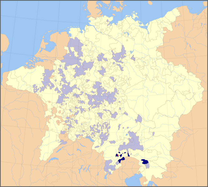
English: Map of the Holy Roman Empire, 1648, with the territories belonging to the prince-bishop of Brixen/Bressanone highlighted
Deutsch: Karte des Hochstiftes Brixen im Heiligen Römischen Reich (1648)
|
| ⧼wm-license-information-date⧽ | |
| ⧼wm-license-information-source⧽ | modified from File:Holy Roman Empire 1648 Ecclesiastical.png; boundaries inferred from Tirol-Atlas (edited by A. Leidlmair, Innsbruck: Universitätsverlag Wagner, 1985), Part F - Geschichte (F. Dörrer, P.W. Haider, F. Huter, W. Keller & W. Leitner), specifically maps F6 (Territoriale Entwicklung, F. Huter & W. Keller) and F9 (Verwaltungsgliederung 1766, F. Dörrer & W. Keller) |
| ⧼wm-license-information-author⧽ | Roke (map), Hanno Sandvik (addition of colours) |
| ⧼wm-license-information-permission⧽ (⧼wm-license-information-permission-reusing-text⧽) |
released by the author under GNU |

|
تاريخ الملف
اضغط على زمن/تاريخ لرؤية الملف كما بدا في هذا الزمن.
| زمن/تاريخ | صورة مصغرة | الأبعاد | مستخدم | تعليق | |
|---|---|---|---|---|---|
| حالي | ★ مراجعة معتمدة 18:22، 9 نوفمبر 2023 | | 681 × 613 (225 كيلوبايت) | Pastakhov (نقاش | مساهمات) | Upload https://upload.wikimedia.org/wikipedia/commons/3/39/HRR_1648_Brixen.png |
لا يمكنك استبدال هذا الملف.
وصلات
لا يوجد صفحات تصل لهذه الصورة.