ملف:Hök Våxtorp.svg

حجم معاينة PNG لذلك الملف ذي الامتداد SVG: 583 × 599 بكسل. البعد الآخر: 1٬992 × 2٬048 بكسل.
الملف الأصلي (ملف SVG، أبعاده 4٬982 × 5٬121 بكسل، حجم الملف: 1٫14 ميجابايت)
| ⧼wm-license-information-description⧽ |
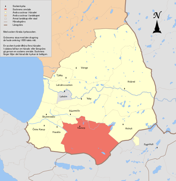
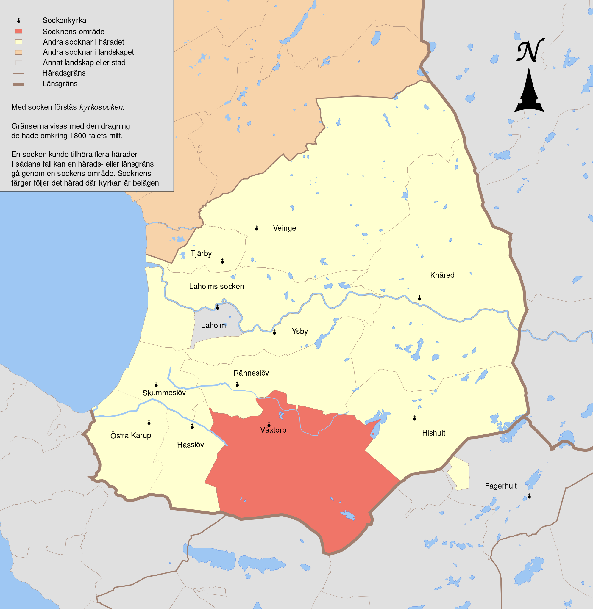
English: Map showing the borders of the civil parish of Våxtorp in the hundred of Hök, Halland County, Halland Region of Sweden. Circa 1850-1900.
|
| ⧼wm-license-information-date⧽ | 2010-09-25 22:02 (UTC) |
| ⧼wm-license-information-source⧽ | |
| ⧼wm-license-information-author⧽ |
|
| [This is a retouched picture, which means that it has been digitally altered from its original version. Modifications: Combined maps to show the hundred of Hök. The original can be viewed here: GS_Ängelholm.svg. Modifications made by Edaen.] Error: {{Lang}}: text has italic markup (help)
|
|
|
هذا الملفُّ مُرخَّص بموجب رخصة المشاع الإبداعي نسبة المُصنَّف إِلى مؤلفه - المشاركة بالمثل 3.0 العامة. |
قالب:Original upload log
This image is a derivative work of the following images:
- File:GS_Halmstad.svg licensed with Cc-by-3.0
- 2010-09-23T08:00:37Z Edaen 5973x4465 (198993 Bytes) {{Information |other_versions={{DerivativeVersions|Bohuslän landskap härader socknar.svg}} Halmstad, based on information from map by Topografiska Corpsen. '''Halmstad''' Grav af F.C. Holm Topografiska Corpsens karta ö
- File:GS_Ljungby.svg licensed with Cc-by-3.0
- 2010-09-22T16:15:45Z Edaen 5946x4463 (397615 Bytes) "fit page to selection"
- 2010-09-22T16:13:39Z Edaen 744x1052 (404595 Bytes) {{Information |other_versions={{DerivativeVersions|Bohuslän landskap härader socknar.svg}} |Description={{en|1=Map showing borders of parishes and hundreds in the vicinity of Ljungby, based on information from map by Topog
- File:GS_Finja.svg licensed with Cc-by-3.0
- 2010-09-25T08:17:03Z Edaen 5969x4438 (482094 Bytes) {{Information |Description={{en|1=Map showing borders of parishes and hundreds in the vicinity of Hässleholm, based on information from map by Topografiska Corpsen. '''9. Finja''' (Hässleholm) Grav. af C. Schleich. Topogr
- File:GS_Ängelholm.svg licensed with Cc-by-3.0
- 2010-09-25T08:20:16Z Edaen 6002x4547 (219668 Bytes) "fit page to selection"
- 2010-09-25T08:18:27Z Edaen 744x1052 (230572 Bytes) {{Information |Description={{en|1=Map showing borders of parishes and hundreds in the vicinity of Ängelholm, based on information from map by Topografiska Corpsen. ''''''3. Ängelholm''' Grav. af C. Schleich. Topografiska
تاريخ الملف
اضغط على زمن/تاريخ لرؤية الملف كما بدا في هذا الزمن.
| زمن/تاريخ | صورة مصغرة | الأبعاد | مستخدم | تعليق | |
|---|---|---|---|---|---|
| حالي | ★ مراجعة معتمدة 07:29، 5 نوفمبر 2023 | | 4٬982 × 5٬121 (1٫14 ميجابايت) | Pastakhov (نقاش | مساهمات) | Upload https://upload.wikimedia.org/wikipedia/commons/0/02/H%C3%B6k_V%C3%A5xtorp.svg |
لا يمكنك استبدال هذا الملف.
وصلات
لا يوجد صفحات تصل لهذه الصورة.