ملف:Gulf Islands map.png
الملف الأصلي (770 × 669 بكسل حجم الملف: 288 كيلوبايت، نوع MIME: image/png)

|
[All images in this gallery should be recreated using vector graphics as an SVG file. This has several advantages; see Commons:Media for cleanup for more information. If an SVG form of this image is already available, please upload it. After uploading an SVG, replace this template with {{vector version available|new image name.svg}}.] Error: {{Lang}}: text has italic markup (help) |
|
العربية | български | català | čeština | dansk | Deutsch | English | Esperanto | español | français | galego | 한국어 | italiano | magyar | lietuvių | 日本語 | Plattdüütsch | Nederlands | norsk | polski | português | română | русский | suomi | svenska | Türkçe | українська | 中文(繁體) | 中文(简体) | +/− | |
وصف قصير
| ⧼wm-license-information-description⧽ |
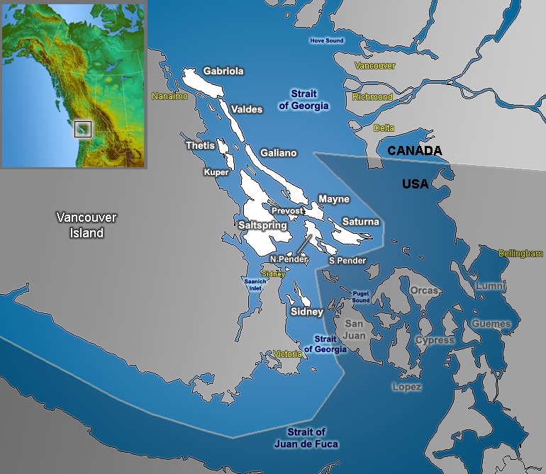
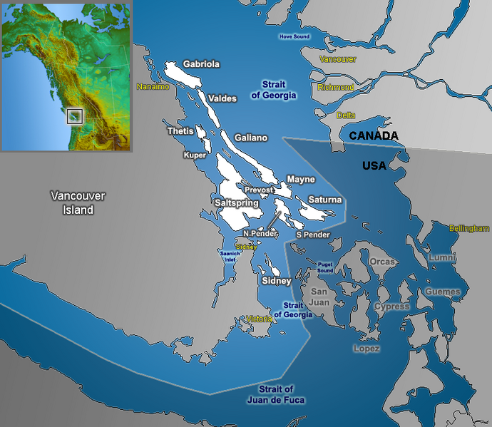
Map of the Southern Gulf Islands (British Columbia) in the Strait of Georgia, with Canada and the US separated |
| ⧼wm-license-information-date⧽ | 2006 |
| ⧼wm-license-information-source⧽ | GIS data |
| ⧼wm-license-information-author⧽ | Qyd |
| ⧼wm-license-information-permission⧽ (⧼wm-license-information-permission-reusing-text⧽) |
All |
The labels on this map are incorrect. The 'Strait of Georgia' does not extend southward into the San Juan Archipelago, nor does 'Puget Sound' extend northward of the Strait of Juan de Fuca.
ترخيص
تاريخ الملف
اضغط على زمن/تاريخ لرؤية الملف كما بدا في هذا الزمن.
| زمن/تاريخ | صورة مصغرة | الأبعاد | مستخدم | تعليق | |
|---|---|---|---|---|---|
| حالي | ★ مراجعة معتمدة 19:43، 2 نوفمبر 2023 | | 770 × 669 (288 كيلوبايت) | Pastakhov (نقاش | مساهمات) | Upload https://upload.wikimedia.org/wikipedia/commons/b/b8/Gulf_Islands_map.png |
لا يمكنك استبدال هذا الملف.
وصلات
لا يوجد صفحات تصل لهذه الصورة.