ملف:Ground Plan of Kenilworth Castle (combined) (11222653716).png
حجم هذه المعاينة: 465 × 600 بكسل. البعد الآخر: 1٬851 × 2٬388 بكسل.
الملف الأصلي (1٬851 × 2٬388 بكسل حجم الملف: 3٫04 ميجابايت، نوع MIME: image/png)
وصف قصير
| ⧼wm-license-information-description⧽ |
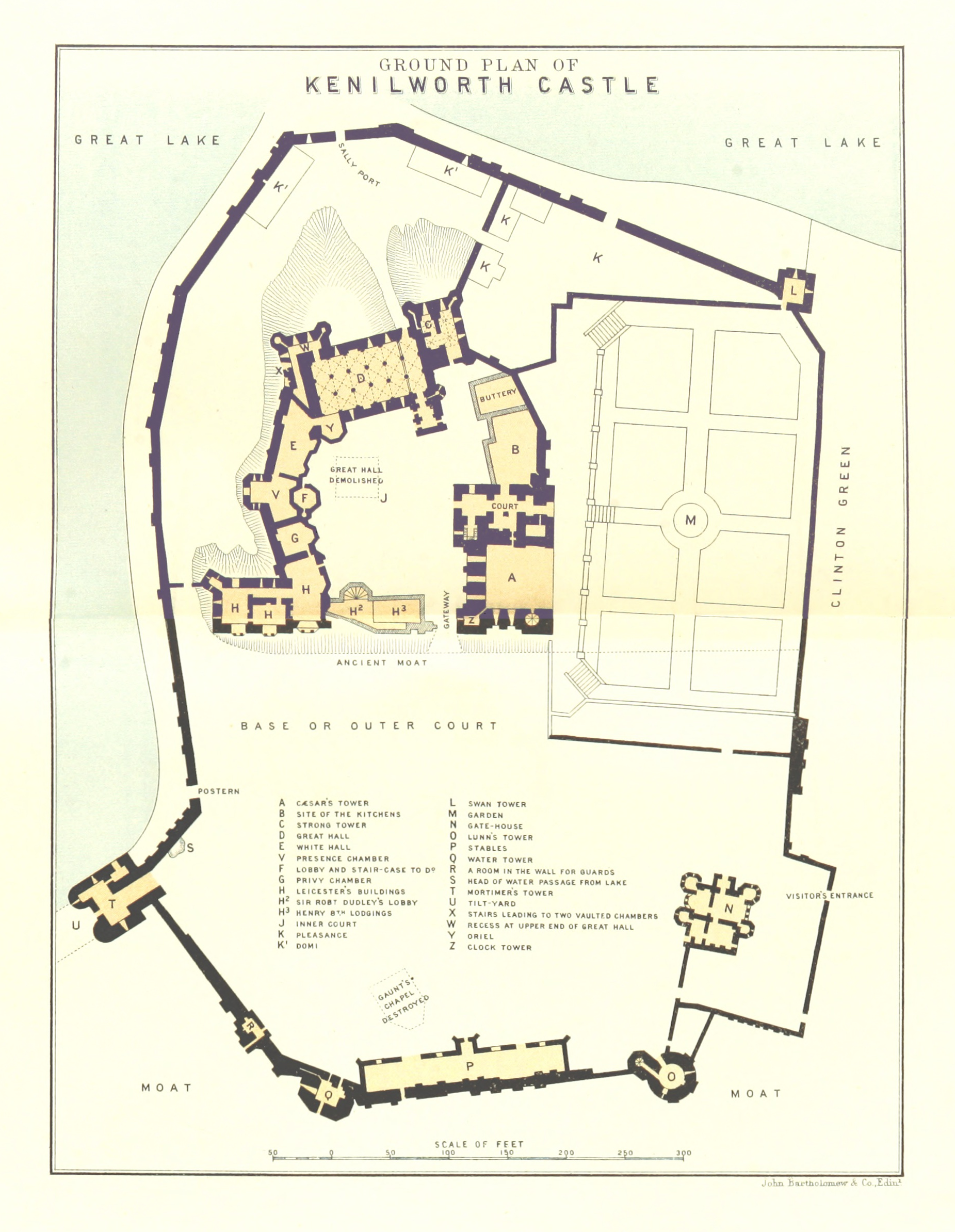
English: Kenilworth Castle - Complete Ground Plan, combined from Pages 184 and 185 of "Shakespeare's Land, being a description of Central and Southern Warwickshire. With ... maps and plans ... and ... original etchings by L. Hart and F. Whitehead"
|
| ⧼wm-license-information-date⧽ | 2013, {{time}} – invalid date format 34 (help) |
| ⧼wm-license-information-source⧽ | Image taken from: Title: "Shakespeare's Land, being a description of Central and Southern Warwickshire. With ... maps and plans ... and ... original etchings by L. Hart and F. Whitehead" Author: TURNER, Charles James Ribton. Shelfmark: "British Library HMNTS 10368.p.1." Pages: 184 and 185 Place of Publishing: Leamington Date of Publishing: 1893 Publisher: F. Glover Issuance: monographic Identifier: 003692469 by British Library |
| ⧼wm-license-information-author⧽ | The British Library |
| ⧼wm-license-information-other-versions⧽ |
ترخيص
قالب:Flickr-no known copyright restrictions قالب:British Library image
تاريخ الملف
اضغط على زمن/تاريخ لرؤية الملف كما بدا في هذا الزمن.
| زمن/تاريخ | صورة مصغرة | الأبعاد | مستخدم | تعليق | |
|---|---|---|---|---|---|
| حالي | ★ مراجعة معتمدة 20:33، 15 يناير 2024 | | 1٬851 × 2٬388 (3٫04 ميجابايت) | Pastakhov (نقاش | مساهمات) | Upload https://upload.wikimedia.org/wikipedia/commons/c/cf/Ground_Plan_of_Kenilworth_Castle_%28combined%29_%2811222653716%29.png |
لا يمكنك استبدال هذا الملف.
وصلات
لا يوجد صفحات تصل لهذه الصورة.
_(11222653716).png&oldid=3886109)