ملف:Grosse Ile Michigan aerial Jan2016.jpg
حجم هذه المعاينة: 800 × 545 بكسل. البعد الآخر: 2٬285 × 1٬557 بكسل.
الملف الأصلي (2٬285 × 1٬557 بكسل حجم الملف: 1٫91 ميجابايت، نوع MIME: image/jpeg)
وصف قصير
| ⧼wm-license-information-description⧽ |
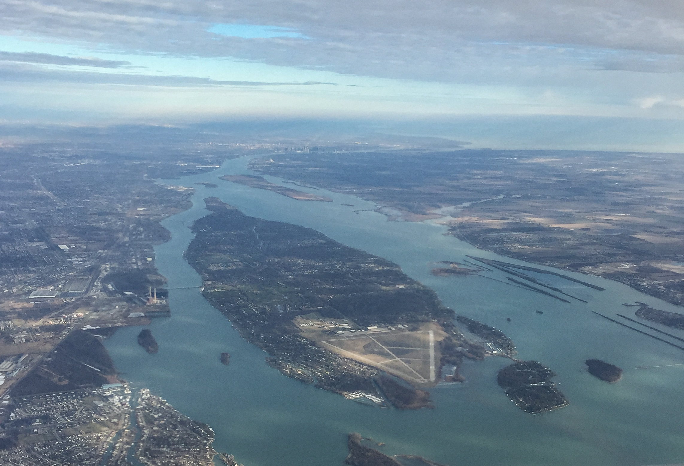
English: Aerial view of Grosse Ile in the Detroit River from the south, as viewed from an aircraft shortly after takeoff from Detroit Metropolitan Airport. Grosse Ile Municipal Airport can be seen at the southern end of the island.
|
| ⧼wm-license-information-date⧽ | قالب:Taken on |
| ⧼wm-license-information-source⧽ | ⧼Wm-license-own-work⧽ |
| ⧼wm-license-information-author⧽ | Tim Kiser (TimK MSI) |
| ⧼wm-license-information-other-versions⧽ |
42°02′33″N 83°10′26″W / 42.042627°N 83.173917°W
ترخيص
|
تاريخ الملف
اضغط على زمن/تاريخ لرؤية الملف كما بدا في هذا الزمن.
| زمن/تاريخ | صورة مصغرة | الأبعاد | مستخدم | تعليق | |
|---|---|---|---|---|---|
| حالي | ★ مراجعة معتمدة 10:48، 1 ديسمبر 2023 | | 2٬285 × 1٬557 (1٫91 ميجابايت) | Pastakhov (نقاش | مساهمات) | Upload https://upload.wikimedia.org/wikipedia/commons/1/1f/Grosse_Ile_Michigan_aerial_Jan2016.jpg |
لا يمكنك استبدال هذا الملف.
وصلات
لا يوجد صفحات تصل لهذه الصورة.