ملف:Grolla - Map of Groenlo, after 1628 (J.Blaeu, 1649).jpg
حجم هذه المعاينة: 783 × 599 بكسل. البعدان الآخران: 2٬560 × 1٬960 بكسل | 5٬500 × 4٬211 بكسل.
الملف الأصلي (5٬500 × 4٬211 بكسل حجم الملف: 2٫7 ميجابايت، نوع MIME: image/jpeg)
وصف قصير
| ⧼wm-license-information-description⧽ |
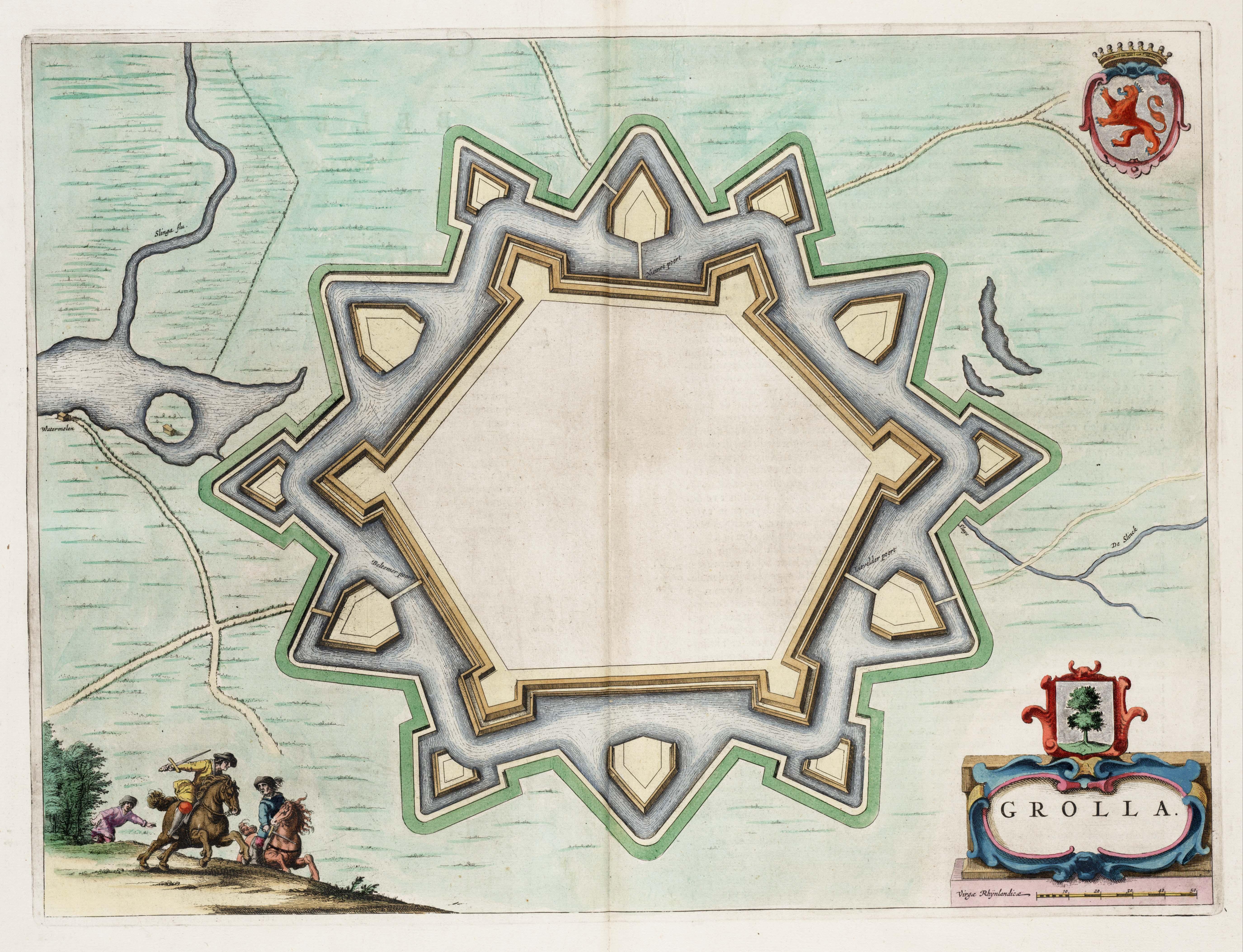
English: Map of the defensive works of Grolla (Groenlo) - the Netherlands, after the restaurations made in 1628. Map found in the Theater of Cities of 1649.
(Dutch) |
| ⧼wm-license-information-date⧽ | 1649 |
| ⧼wm-license-information-source⧽ | Toonneel der Steeden van de vereenighde Nederlanden |
| ⧼wm-license-information-author⧽ | J.Blaeu |
| ⧼wm-license-information-permission⧽ (⧼wm-license-information-permission-reusing-text⧽) |
Public Domain |
ترخيص
|
|
This file is in the ملكية عامة because its copyright has expired in the United States and those countries with a copyright term of no more than the life of the author plus 100 years.
|
تاريخ الملف
اضغط على زمن/تاريخ لرؤية الملف كما بدا في هذا الزمن.
| زمن/تاريخ | صورة مصغرة | الأبعاد | مستخدم | تعليق | |
|---|---|---|---|---|---|
| حالي | ★ مراجعة معتمدة 19:35، 27 أكتوبر 2023 | | 5٬500 × 4٬211 (2٫7 ميجابايت) | Pastakhov (نقاش | مساهمات) | Upload https://upload.wikimedia.org/wikipedia/commons/c/c2/Grolla_-_Map_of_Groenlo%2C_after_1628_%28J.Blaeu%2C_1649%29.jpg |
لا يمكنك استبدال هذا الملف.
وصلات
لا يوجد صفحات تصل لهذه الصورة.
.jpg&oldid=3269837)