ملف:Greenhill, Brent geograph-3961471-by-Ben-Brooksbank.jpg
حجم هذه المعاينة: 800 × 453 بكسل. البعد الآخر: 2٬395 × 1٬355 بكسل.
الملف الأصلي (2٬395 × 1٬355 بكسل حجم الملف: 2٫26 ميجابايت، نوع MIME: image/jpeg)
وصف قصير
| ⧼wm-license-information-description⧽ |
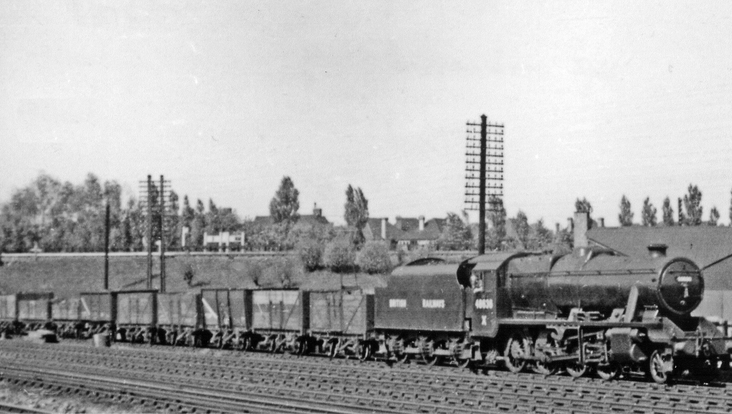
English: Up mineral on West Coast Main Line near Kenton, 1948.
View northward from by Northwick Park (LT) station, across the six tracks of the WCML between South Kenton and Kenton, with the over-bridge behind carrying the LT/Met&GC lines from London (Baker Street/Marylebone) (to right), (to left) to Harrow-on-the-Hill/Uxbridge/Amersham/Aylesbury by LT and (by ex-GCR) Leicester and the North. The Up class J mineral on the WCML Up Slow line is headed by a recently repaired LMS Stanier 8F 2-8-0, No. 48636 (built 1943 at the SR Brighton Works, eventually withdrawn 8/67): as this was shortly after Nationalisation, it had been repainted in the earliest British Railways livery, before a BR emblem had been introduced. |
| ⧼wm-license-information-date⧽ | 1948 |
| ⧼wm-license-information-source⧽ | From geograph.org.uk |
| ⧼wm-license-information-author⧽ | Ben Brooksbank |
| ⧼wm-license-information-permission⧽ (⧼wm-license-information-permission-reusing-text⧽) |
Creative Commons Attribution Share-alike license 2.0 |
| ⧼wm-license-cc-attribution⧽ (قالب:I18n/Credit line) |
Ben Brooksbank / Up mineral on West Coast Main Line near Kenton, 1948 / |
ترخيص
تاريخ الملف
اضغط على زمن/تاريخ لرؤية الملف كما بدا في هذا الزمن.
| زمن/تاريخ | صورة مصغرة | الأبعاد | مستخدم | تعليق | |
|---|---|---|---|---|---|
| حالي | ★ مراجعة معتمدة 22:07، 6 أكتوبر 2023 | | 2٬395 × 1٬355 (2٫26 ميجابايت) | Pastakhov (نقاش | مساهمات) | Upload https://upload.wikimedia.org/wikipedia/commons/7/7f/Greenhill%2C_Brent_geograph-3961471-by-Ben-Brooksbank.jpg |
لا يمكنك استبدال هذا الملف.
وصلات
لا يوجد صفحات تصل لهذه الصورة.