ملف:Green Island Sentinel-2B MSI 2020-06-04.jpg
حجم هذه المعاينة: 596 × 599 بكسل. البعد الآخر: 756 × 760 بكسل.
الملف الأصلي (756 × 760 بكسل حجم الملف: 546 كيلوبايت، نوع MIME: image/jpeg)
وصف قصير
| ⧼wm-license-information-description⧽ |
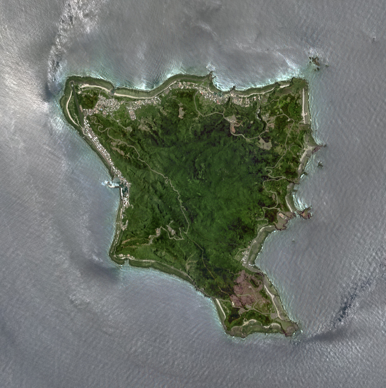
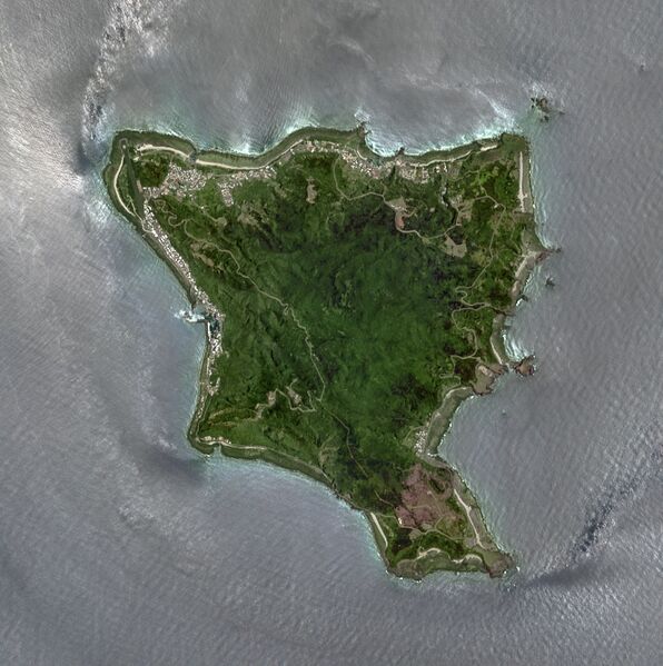
English: The Green Island, sitting about 30 kilometers east of the Taitung coastline in eastern Taiwan, was surrounded by the wavy silver Pacific Ocean reflected by sunlight in this true-color and un-deglinted image, which was captured by the MultiSpectral Instrument (MSI) aboard ESA's Sentinel-2B satellite on June 4, 2020 (UTC).
|
| ⧼wm-license-information-date⧽ | 2020-06-04 02:25:49.024 |
| ⧼wm-license-information-source⧽ | Copernicus Open Access Hub |
| ⧼wm-license-information-author⧽ |
|
22°39′30″N 121°29′17″E / 22.658333°N 121.488056°E
ترخيص
تاريخ الملف
اضغط على زمن/تاريخ لرؤية الملف كما بدا في هذا الزمن.
| زمن/تاريخ | صورة مصغرة | الأبعاد | مستخدم | تعليق | |
|---|---|---|---|---|---|
| حالي | ★ مراجعة معتمدة 01:42، 27 نوفمبر 2023 | | 756 × 760 (546 كيلوبايت) | Pastakhov (نقاش | مساهمات) | Upload https://upload.wikimedia.org/wikipedia/commons/5/5c/Green_Island_Sentinel-2B_MSI_2020-06-04.jpg |
لا يمكنك استبدال هذا الملف.
وصلات
لا يوجد صفحات تصل لهذه الصورة.