ملف:Great Salt Lake by Sentinel-2.jpg
حجم هذه المعاينة: 629 × 599 بكسل. البعدان الآخران: 2٬150 × 2٬048 بكسل | 7٬536 × 7٬180 بكسل.
الملف الأصلي (7٬536 × 7٬180 بكسل حجم الملف: 38٫85 ميجابايت، نوع MIME: image/jpeg)
وصف قصير
| ⧼wm-license-information-description⧽ |
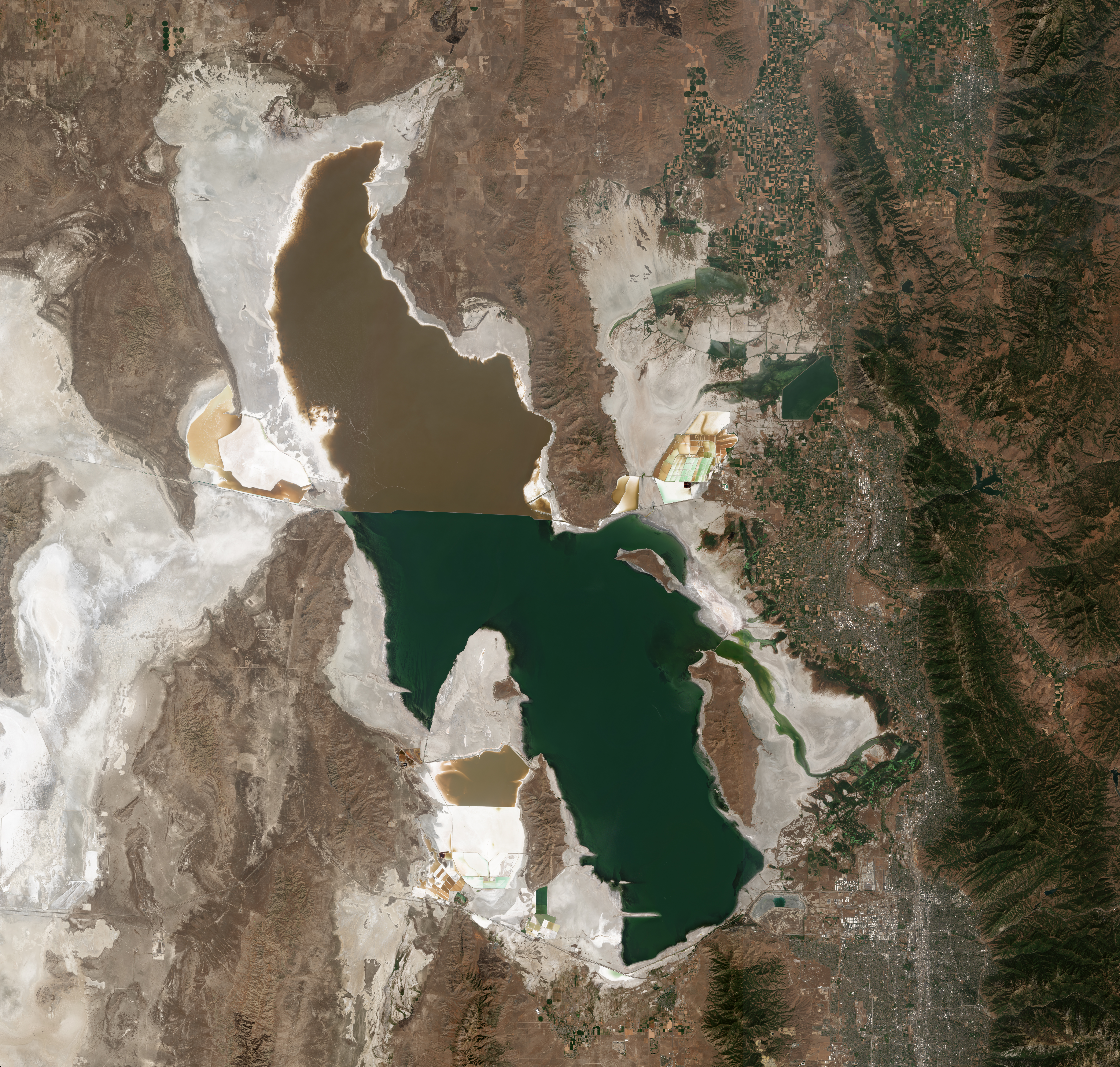
English: Satellite photo of the Great Salt Lake from August 2018 after years of drought, reaching near-record lows. The difference in colors between the northern and southern portions of the lake is the result of the Lucin Cutoff, a railroad causeway. The image was acquired by the MSI sensor on the Sentinel-2B satellite (Resolution: 20m, RGB Composites: True color, Band 4-3-2).
|
| ⧼wm-license-information-date⧽ | 2018 |
| ⧼wm-license-information-source⧽ | https://scihub.copernicus.eu/dhus/#/home |
| ⧼wm-license-information-author⧽ | Copernicus Sentinel-2, ESA |
| ⧼wm-license-information-other-versions⧽ |
Original 10m-Res Version (Large File Size) |
.jpg)
ترخيص
تاريخ الملف
اضغط على زمن/تاريخ لرؤية الملف كما بدا في هذا الزمن.
| زمن/تاريخ | صورة مصغرة | الأبعاد | مستخدم | تعليق | |
|---|---|---|---|---|---|
| حالي | ★ مراجعة معتمدة 14:30، 7 أكتوبر 2023 | | 7٬536 × 7٬180 (38٫85 ميجابايت) | Pastakhov (نقاش | مساهمات) | Upload https://upload.wikimedia.org/wikipedia/commons/3/37/Great_Salt_Lake_by_Sentinel-2.jpg |
لا يمكنك استبدال هذا الملف.
وصلات
لا يوجد صفحات تصل لهذه الصورة.
معلومات الصورة (ميتا)
تصنيفات:
- Satellite pictures of Great Salt Lake
- Landforms bordering the Great Salt Lake
- Promontory Mountains
- Antelope Island
- Stansbury Island
- Fremont Island
- Hogup Mountains
- Curlew Valley
- Hansel Mountains
- North Promontory Mountains
- Blue Creek Valley
- Lakeside Mountains
- Puddle Valley
- Grassy Mountains
- Cedar Mountains (Tooele County)
- Skull Valley (Utah)
- Stansbury Mountains
- Tooele Valley
- Oquirrh Mountains
- Pink lakes
- Lucin Cutoff
- Photos of the United States by Sentinel-2