ملف:Glasgowairportmap.png
حجم هذه المعاينة: 598 × 599 بكسل. البعد الآخر: 998 × 1٬000 بكسل.
الملف الأصلي (998 × 1٬000 بكسل حجم الملف: 572 كيلوبايت، نوع MIME: image/png)
وصف قصير
| ⧼wm-license-information-description⧽ |
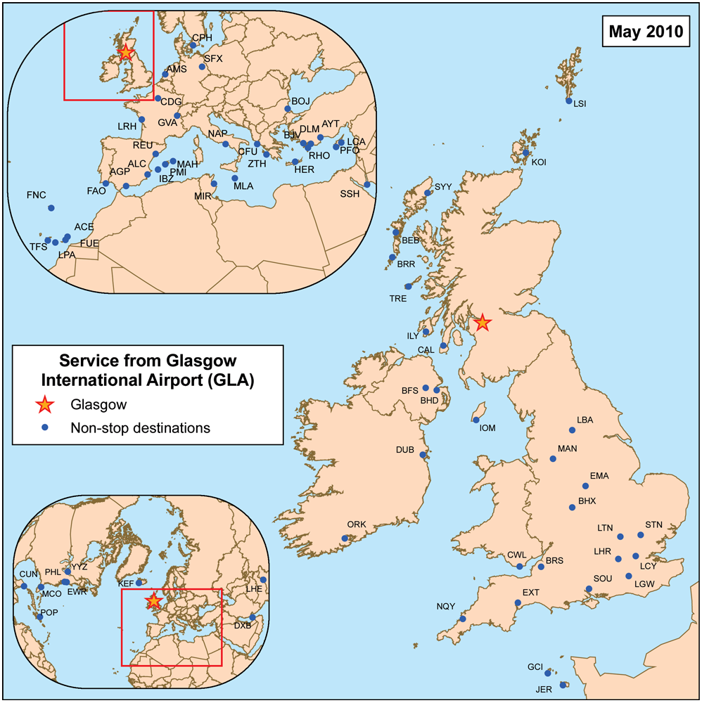
This is a route map for Glasgow International Airport as of May 2010. Map is an Azimuthal equidistant projection centered on the airport so straight lines from Glasgow are along great circle routes. |
| ⧼wm-license-information-date⧽ | 2007 |
| ⧼wm-license-information-source⧽ | self-made, data source. |
| ⧼wm-license-information-author⧽ | Kmusser |
ترخيص
|
تاريخ الملف
اضغط على زمن/تاريخ لرؤية الملف كما بدا في هذا الزمن.
| زمن/تاريخ | صورة مصغرة | الأبعاد | مستخدم | تعليق | |
|---|---|---|---|---|---|
| حالي | ★ مراجعة معتمدة 20:43، 19 أكتوبر 2023 | | 998 × 1٬000 (572 كيلوبايت) | Pastakhov (نقاش | مساهمات) | Upload https://upload.wikimedia.org/wikipedia/commons/2/2f/Glasgowairportmap.png |
لا يمكنك استبدال هذا الملف.
وصلات
لا يوجد صفحات تصل لهذه الصورة.