ملف:Ghana 2008 Parliamentary Map.png
حجم هذه المعاينة: 439 × 600 بكسل. البعد الآخر: 1٬608 × 2٬197 بكسل.
الملف الأصلي (1٬608 × 2٬197 بكسل حجم الملف: 108 كيلوبايت، نوع MIME: image/png)
وصف قصير
| ⧼wm-license-information-description⧽ |
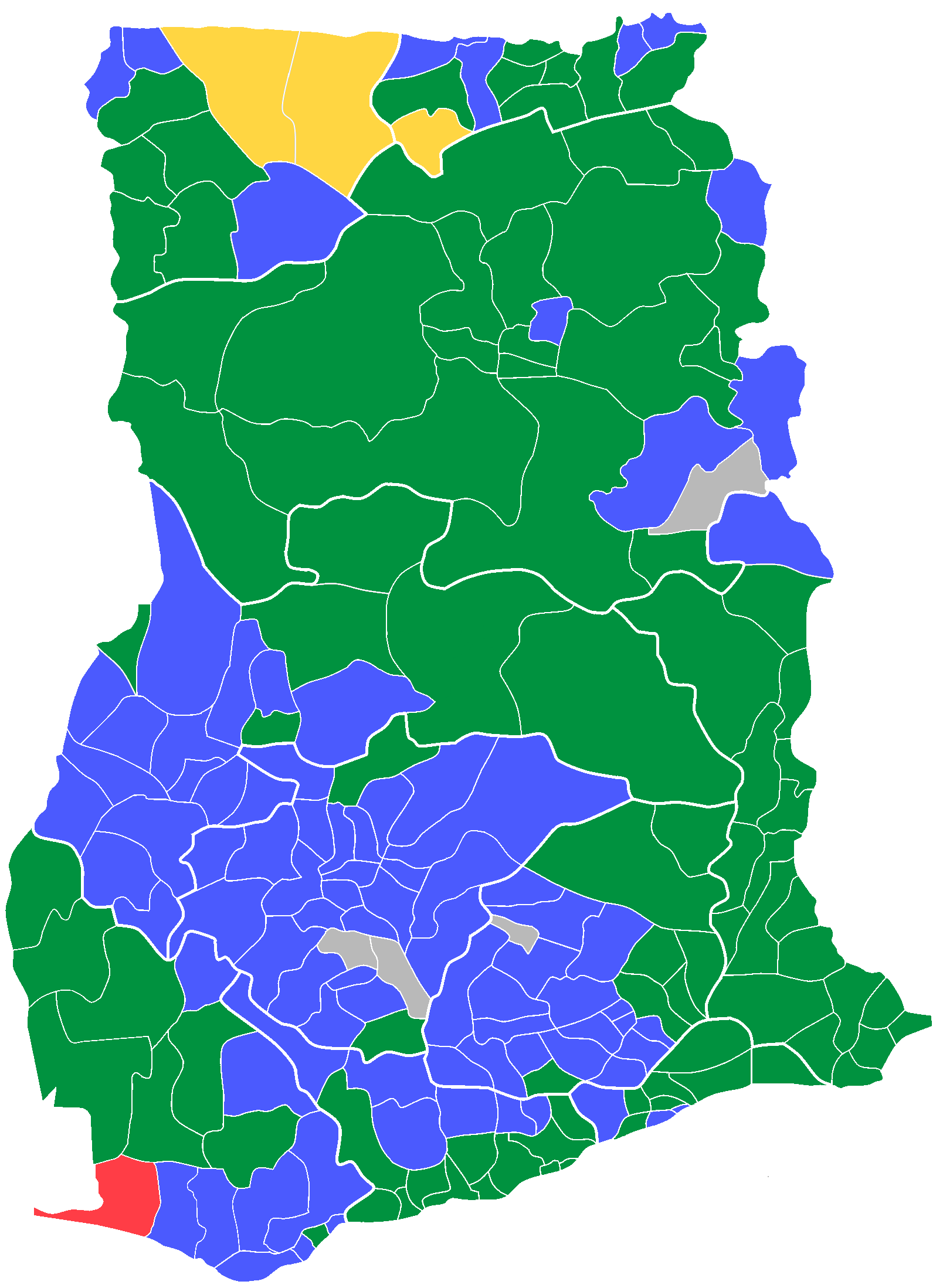
English: Map of Ghana's parliamentary constituencies as per MP's party affiliation. NB: Where constituencies are too small to be shown (i.e. Accra and Tamale Metropolitan Areas) the majority party elected in the district is shown.
Green: National Democratic Congress (NDC) Blue: New Patriotic Party (NPP) Yellow: People's National Convention (PNC) Red: Convention People's Party (CPP) Grey: Independent |
| ⧼wm-license-information-date⧽ | |
| ⧼wm-license-information-source⧽ | Own work using Paint.Net |
| ⧼wm-license-information-author⧽ | Pfbray |
ترخيص
تاريخ الملف
اضغط على زمن/تاريخ لرؤية الملف كما بدا في هذا الزمن.
| زمن/تاريخ | صورة مصغرة | الأبعاد | مستخدم | تعليق | |
|---|---|---|---|---|---|
| حالي | ★ مراجعة معتمدة 00:28، 16 أكتوبر 2023 | | 1٬608 × 2٬197 (108 كيلوبايت) | Pastakhov (نقاش | مساهمات) | Upload https://upload.wikimedia.org/wikipedia/commons/7/77/Ghana_2008_Parliamentary_Map.png |
لا يمكنك استبدال هذا الملف.
وصلات
لا يوجد صفحات تصل لهذه الصورة.