ملف:Gettysburg-Open-Battlefield.svg

حجم معاينة PNG لذلك الملف ذي الامتداد SVG: 501 × 599 بكسل. البعد الآخر: 1٬712 × 2٬048 بكسل.
الملف الأصلي (ملف SVG، أبعاده 5٬613 × 6٬716 بكسل، حجم الملف: 1٫88 ميجابايت)
وصف قصير
| ⧼wm-license-information-description⧽ |
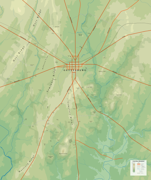
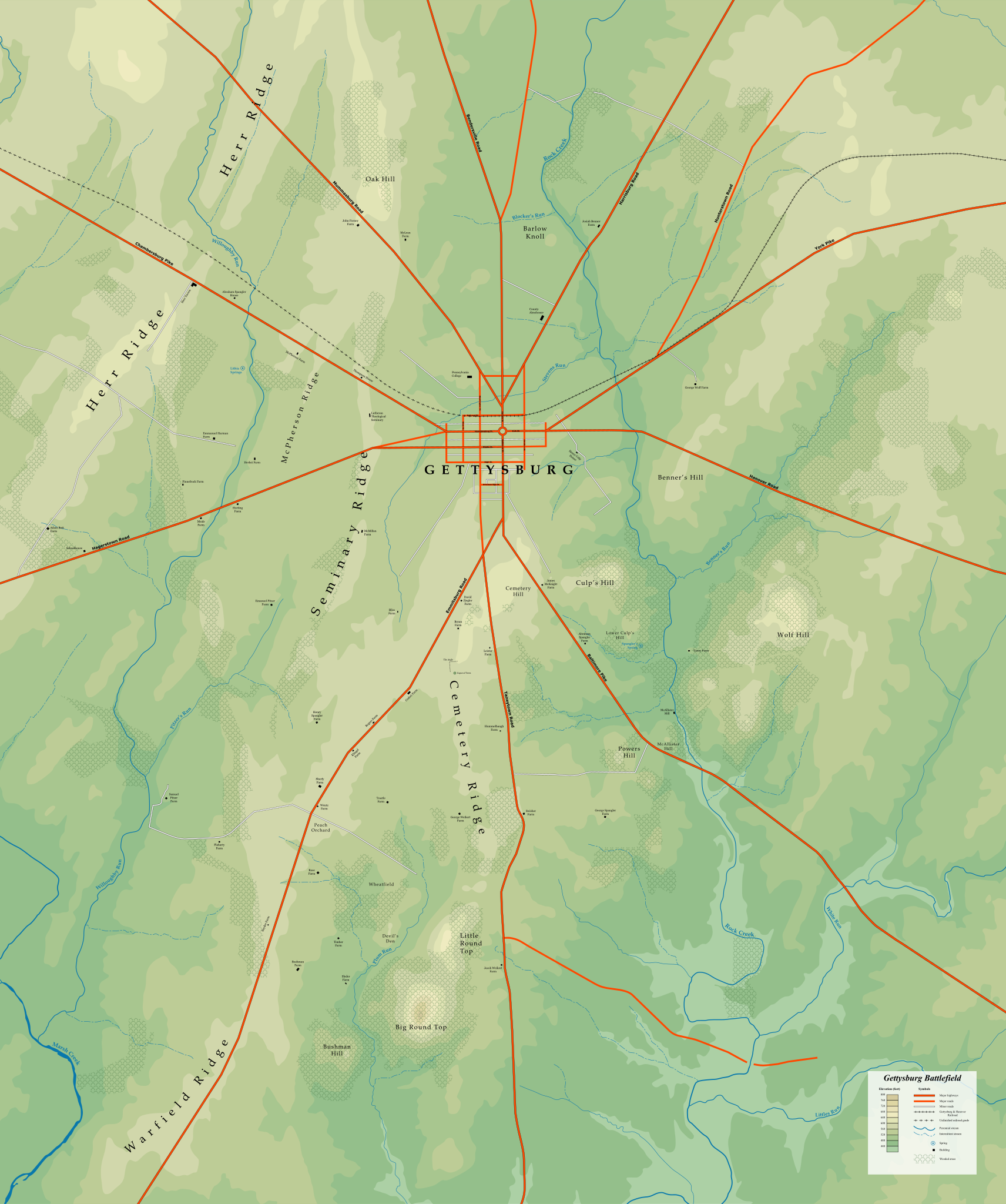
English: Map of the Gettysburg Battlefield with historic street names, geographic features, and significant buildings marked.
|
||
| ⧼wm-license-information-date⧽ | 2015 | ||
| ⧼wm-license-information-source⧽ | ⧼Wm-license-own-work⧽ The topographic information was derived from current and historic United States Geological Survey (USGS) maps. USGS public maps are in the public domain per the license below:
|
||
| ⧼wm-license-information-author⧽ | Veggies |
ترخيص
|

تاريخ الملف
اضغط على زمن/تاريخ لرؤية الملف كما بدا في هذا الزمن.
| زمن/تاريخ | صورة مصغرة | الأبعاد | مستخدم | تعليق | |
|---|---|---|---|---|---|
| حالي | ★ مراجعة معتمدة 04:50، 25 ديسمبر 2023 | | 5٬613 × 6٬716 (1٫88 ميجابايت) | Pastakhov (نقاش | مساهمات) | Upload https://upload.wikimedia.org/wikipedia/commons/9/94/Gettysburg-Open-Battlefield.svg |
لا يمكنك استبدال هذا الملف.
وصلات
لا يوجد صفحات تصل لهذه الصورة.