ملف:Germanic tribes settlements 750BC-1AD.svg

حجم معاينة PNG لذلك الملف ذي الامتداد SVG: 527 × 390 بكسل. البعد الآخر: 2٬560 × 1٬894 بكسل.
الملف الأصلي (ملف SVG، أبعاده 527 × 390 بكسل، حجم الملف: 201 كيلوبايت)
وصف قصير
| ⧼wm-license-information-description⧽ |
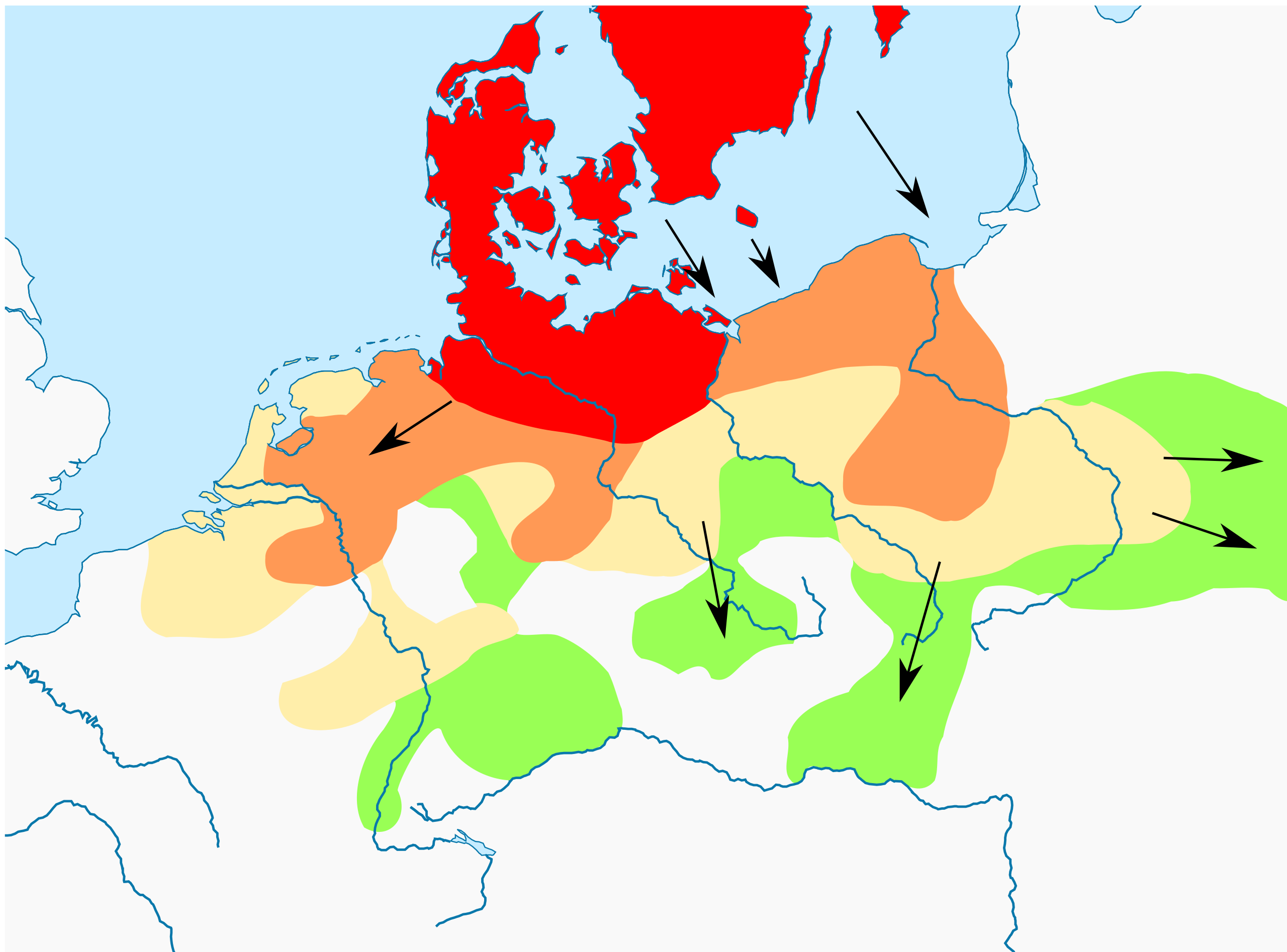
English: Based on p. 108 in the Penguin Atlas of World History, volume 1, from the Beginning to the Eve of the French Revolution. 1988. ISBN 0-14-051054-0. Note that the map assumes that the w:Nordwestblock was Germanized before 500 BC. This is uncertain; alternative proposals hold that the area near the mouths of the Rhine came under a Germanic superstrate only in the 1st century BC.
Legend: Settlements before 750 BC
New settlements after 750 BC until 1 AD
New settlements until 100 AD
New settlements after 100 AD |
| ⧼wm-license-information-date⧽ | 2013, {{time}} – invalid date format 30 (help) |
| ⧼wm-license-information-source⧽ | |
| ⧼wm-license-information-author⧽ |
|
.png)
ترخيص
|
|
هذا الملفُّ مُرخَّص بموجب رخصة المشاع الإبداعي نسبة المُصنَّف إِلى مؤلفه - المشاركة بالمثل 3.0 العامة. |
تاريخ الملف
اضغط على زمن/تاريخ لرؤية الملف كما بدا في هذا الزمن.
| زمن/تاريخ | صورة مصغرة | الأبعاد | مستخدم | تعليق | |
|---|---|---|---|---|---|
| حالي | ★ مراجعة معتمدة 23:30، 10 نوفمبر 2023 | | 527 × 390 (201 كيلوبايت) | Pastakhov (نقاش | مساهمات) | Upload https://upload.wikimedia.org/wikipedia/commons/5/5c/Germanic_tribes_settlements_750BC-1AD.svg |
لا يمكنك استبدال هذا الملف.
وصلات
لا يوجد صفحات تصل لهذه الصورة.