ملف:Georgia Shida Kartli location map.svg

حجم معاينة PNG لذلك الملف ذي الامتداد SVG: 640 × 600 بكسل. البعد الآخر: 2٬185 × 2٬048 بكسل.
الملف الأصلي (ملف SVG، أبعاده 783 × 734 بكسل، حجم الملف: 103 كيلوبايت)
وصف قصير
| ⧼wm-license-information-description⧽ |
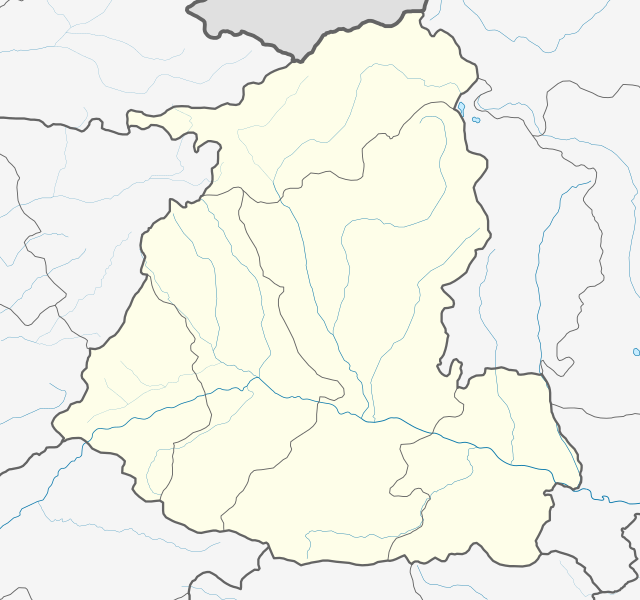
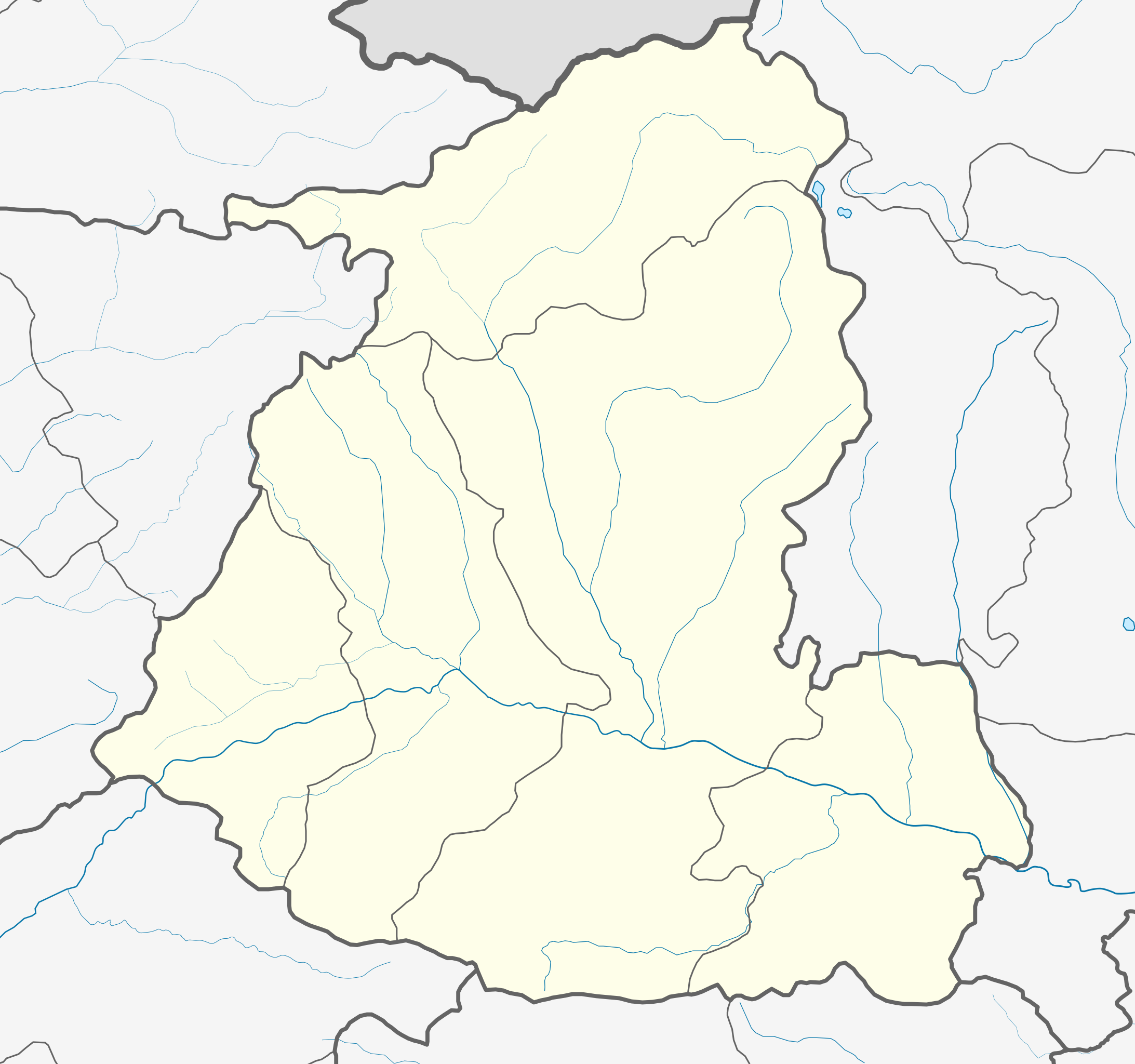
English: Location map of Shida Kartli
قالب:Ka Mercator projection. Geographic limits of the map:
|
| ⧼wm-license-information-date⧽ | 2016 |
| ⧼wm-license-information-source⧽ | ⧼Wm-license-own-work⧽ |
| ⧼wm-license-information-author⧽ | Giorgi Balakhadze |
ترخيص
قالب:Original upload log
قالب:Original description page
| زمن/تاريخ | الأبعاد | مستخدم | تعليق |
|---|---|---|---|
| 2016-06-17 13:27:49 | 783× 734× | Giorgi Balakhadze | fix |
| 2016-06-17 13:23:40 | 783× 734× | Giorgi Balakhadze | {{Copy to Commons|human=Giorgi Balakhadze}} == Summary == {{Information |Description={{en|Location map of [[:en:Shida Kartli|Shida Kartli]]}} </br>Mercator projection. Geographic limits of the map: * N: 42.65° N * S: 41.68° N * W: 43.31.8° E * E: 44... |
تاريخ الملف
اضغط على زمن/تاريخ لرؤية الملف كما بدا في هذا الزمن.
| زمن/تاريخ | صورة مصغرة | الأبعاد | مستخدم | تعليق | |
|---|---|---|---|---|---|
| حالي | ★ مراجعة معتمدة 11:42، 5 أكتوبر 2023 | | 783 × 734 (103 كيلوبايت) | Pastakhov (نقاش | مساهمات) | Upload https://upload.wikimedia.org/wikipedia/commons/6/60/Georgia_Shida_Kartli_location_map.svg |
لا يمكنك استبدال هذا الملف.
وصلات
الصفحات التالية تحتوي على وصلة لهذه الصورة: