ملف:Gateshead UK locator map.svg

حجم معاينة PNG لذلك الملف ذي الامتداد SVG: 682 × 599 بكسل. البعد الآخر: 2٬331 × 2٬048 بكسل.
الملف الأصلي (ملف SVG، أبعاده 1٬425 × 1٬252 بكسل، حجم الملف: 685 كيلوبايت)
| ⧼wm-license-information-description⧽ |
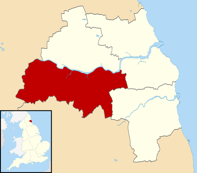
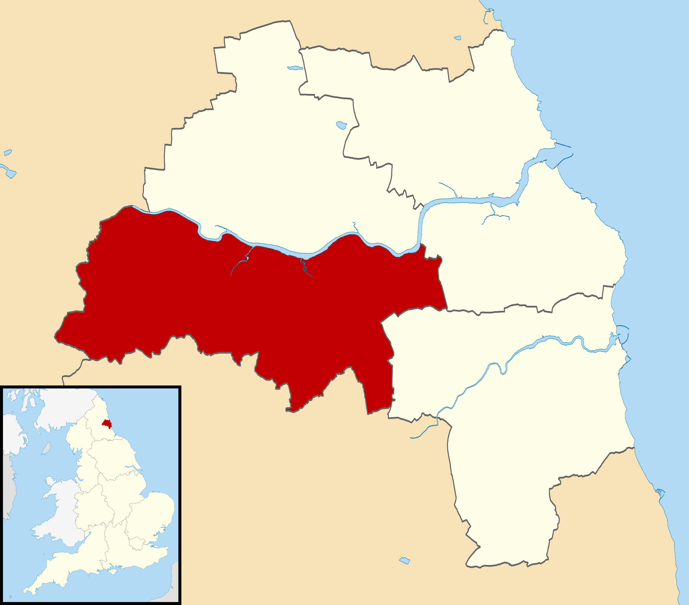
Map of Tyne and Wear, with Gateshead highlighted. |
| ⧼wm-license-information-date⧽ | 2011-08-20 09:49 (UTC) |
| ⧼wm-license-information-source⧽ | |
| ⧼wm-license-information-author⧽ |
|
.svg&action=edit&redlink=1)
|
قالب:Original upload log
This image is a derivative work of the following images:
- File:Tyne and Wear UK district map (blank).svg licensed with Cc-by-sa-3.0
- 2010-08-22T08:20:12Z Nilfanion 1425x1252 (699394 Bytes) +inset, water colour tweak
- 2010-07-16T23:57:02Z Nilfanion 1425x1252 (341629 Bytes) {{Information |Description=Map of [[w:Tyne and Wear|Tyne and Wear]], UK with districts shown. Equirectangular map projection on WGS 84 datum, with N/S stretched 170% Geographic limits: *West: 1.90W *East: 1.30W *North: 55.0
تاريخ الملف
اضغط على زمن/تاريخ لرؤية الملف كما بدا في هذا الزمن.
| زمن/تاريخ | صورة مصغرة | الأبعاد | مستخدم | تعليق | |
|---|---|---|---|---|---|
| حالي | ★ مراجعة معتمدة 16:05، 12 يناير 2024 | | 1٬425 × 1٬252 (685 كيلوبايت) | Pastakhov (نقاش | مساهمات) | Upload https://upload.wikimedia.org/wikipedia/commons/9/96/Gateshead_UK_locator_map.svg |
لا يمكنك استبدال هذا الملف.
وصلات
لا يوجد صفحات تصل لهذه الصورة.