ملف:Galveston island 0001.png
لا توجد دقة أعلى متوفرة.
Galveston_island_0001.png (534 × 566 بكسل حجم الملف: 34 كيلوبايت، نوع MIME: image/png)
وصف قصير
| ⧼wm-license-information-description⧽ |
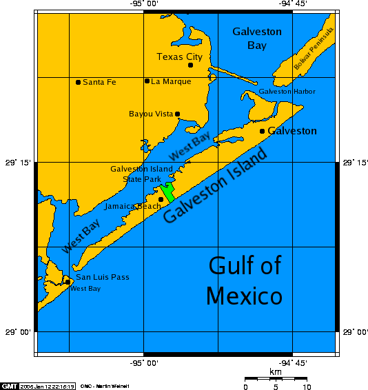
English: A map of Galveston Island, a barrier island on Galveston Bay of the Gulf Coast of Texas.
|
| ⧼wm-license-information-date⧽ | قالب:Original upload date |
| ⧼wm-license-information-source⧽ | Transfered from en.wikipedia Transfer was stated to be made by User:PaulVIF. |
| ⧼wm-license-information-author⧽ | Original uploader was Kharker at en.wikipedia |
| ⧼wm-license-information-permission⧽ (⧼wm-license-information-permission-reusing-text⧽) |
GFDL-SELF-WITH-DISCLAIMERS; Released under the GNU Free Documentation License. |
ترخيص

|
قالب:Original upload log
قالب:Original description page
- 2006-01-12 21:50 Kharker 534×566×8 (34675 bytes) A map of [[Galveston Island]], a [[barrier island]] on the [[Texas]] Gulf coast in the [[United States]], about 50 miles (80 kilometers) south of the city of [[Houston, Texas|Houston]]. The map was created with this [http://www.aquarius.geomar.de/omc/ on
تاريخ الملف
اضغط على زمن/تاريخ لرؤية الملف كما بدا في هذا الزمن.
| زمن/تاريخ | صورة مصغرة | الأبعاد | مستخدم | تعليق | |
|---|---|---|---|---|---|
| حالي | ★ مراجعة معتمدة 07:12، 4 ديسمبر 2023 | | 534 × 566 (34 كيلوبايت) | Pastakhov (نقاش | مساهمات) | Upload https://upload.wikimedia.org/wikipedia/commons/3/3f/Galveston_island_0001.png |
لا يمكنك استبدال هذا الملف.
وصلات
لا يوجد صفحات تصل لهذه الصورة.