ملف:Fukushima accidents overview map.svg

حجم معاينة PNG لذلك الملف ذي الامتداد SVG: 449 × 599 بكسل. البعد الآخر: 1٬535 × 2٬048 بكسل.
الملف الأصلي (ملف SVG، أبعاده 512 × 683 بكسل، حجم الملف: 161 كيلوبايت)
وصف قصير
قالب:Igen
| ⧼wm-license-information-description⧽ |
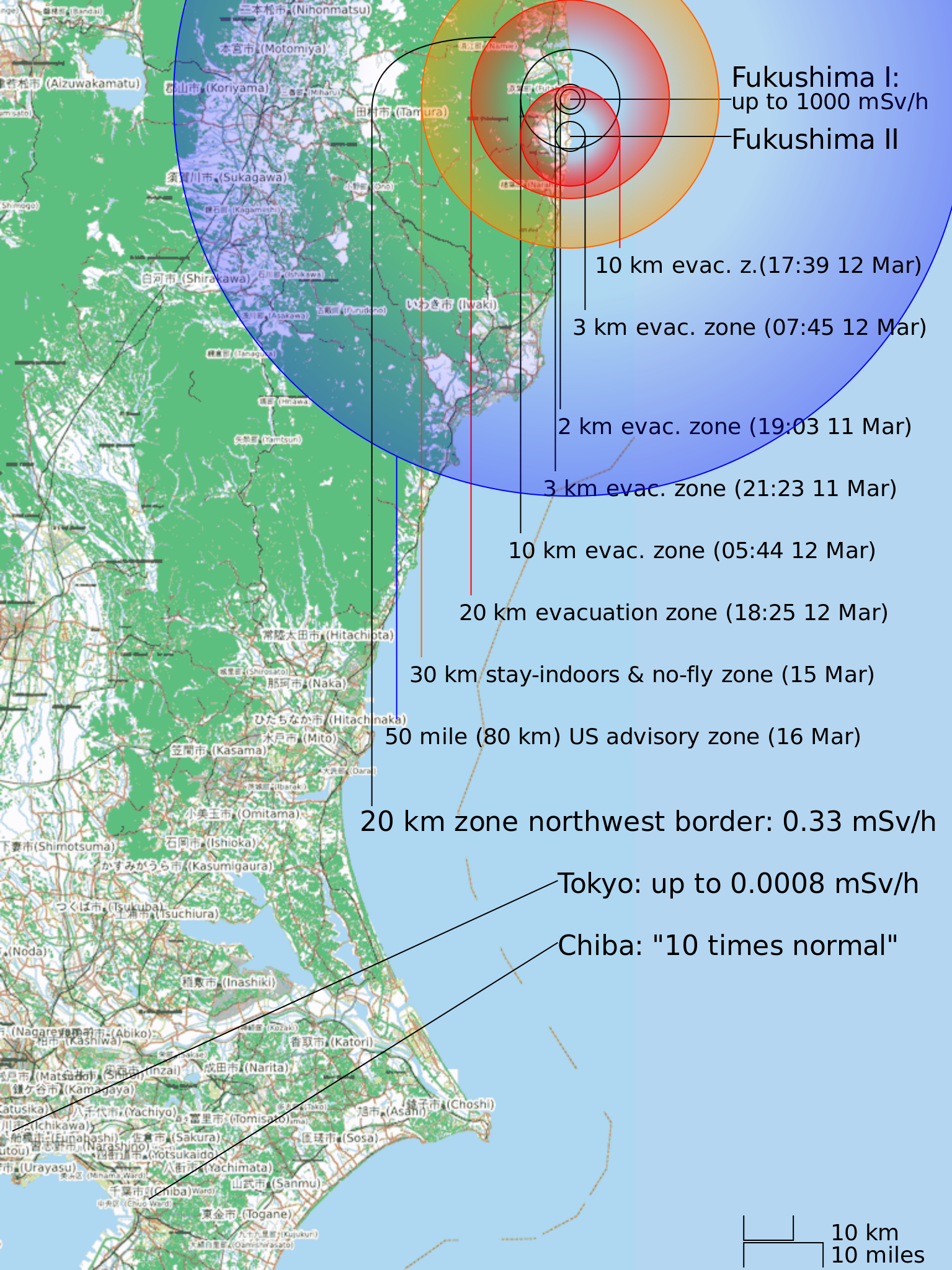
English: Fukushima I and II Nuclear Accidents Overview Map showing evacuation and other zone progression and selected radiation levels as of March 15.
|
| ⧼wm-license-information-date⧽ | 2011 |
| ⧼wm-license-information-source⧽ | ⧼Wm-license-own-work⧽ (قالب:Original text) |
| ⧼wm-license-information-author⧽ | CMG Lee and OpenStreetMap contributors, CC-BY-SA |
| ⧼wm-license-information-permission⧽ (⧼wm-license-information-permission-reusing-text⧽) |
(c) OpenStreetMap contributors, CC-BY-SA |
ترخيص
|
تاريخ الملف
اضغط على زمن/تاريخ لرؤية الملف كما بدا في هذا الزمن.
| زمن/تاريخ | صورة مصغرة | الأبعاد | مستخدم | تعليق | |
|---|---|---|---|---|---|
| حالي | ★ مراجعة معتمدة 07:13، 7 نوفمبر 2023 | | 512 × 683 (161 كيلوبايت) | Pastakhov (نقاش | مساهمات) | Upload https://upload.wikimedia.org/wikipedia/commons/b/bc/Fukushima_accidents_overview_map.svg |
لا يمكنك استبدال هذا الملف.
وصلات
لا يوجد صفحات تصل لهذه الصورة.