ملف:Freie Republik Schwarzenberg 1945 Karte.svg

حجم معاينة PNG لذلك الملف ذي الامتداد SVG: 731 × 599 بكسل. البعد الآخر: 2٬498 × 2٬048 بكسل.
الملف الأصلي (ملف SVG، أبعاده 1٬000 × 820 بكسل، حجم الملف: 101 كيلوبايت)
وصف قصير
قالب:Igen
| ⧼wm-license-information-description⧽ |
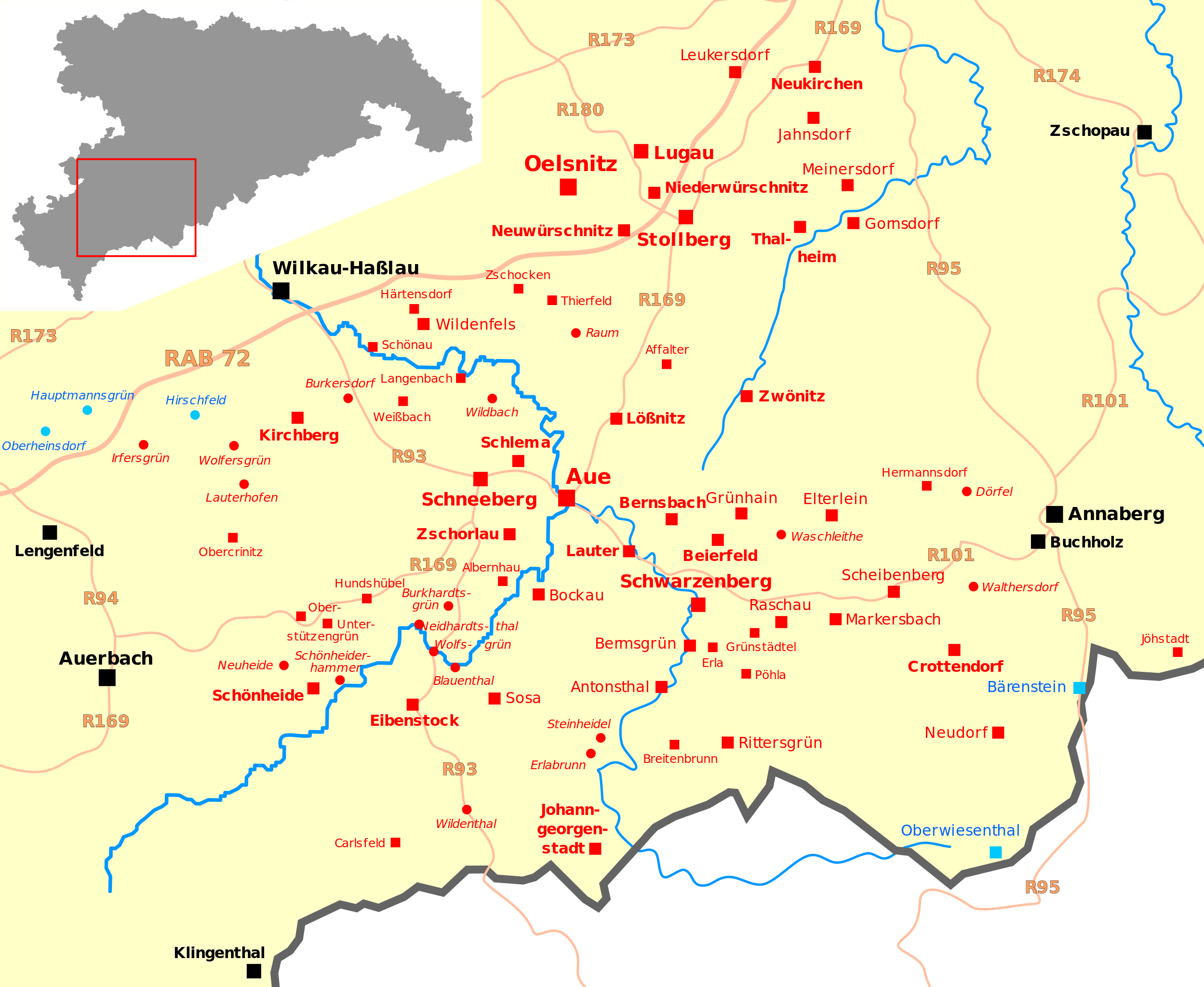
Map of the localities in the saxon part of the Ore Mountains reliably unoccupied from May 8, to June 24, 1945, later called Free Republic of Schwarzenberg (no complete list) unoccupied locality
presumably unoccupied locality
occupied locality, for orientation
List of localities from: Jochen Czerny (Hrsg.): Republik im Niemandsland. Ein Schwarzenberg-Lesebuch, Rosa-Luxemburg-Stiftung Sachsen, Schkeuditz 1997, ISBN 978-3-929994-94-0, S. 369 |
| ⧼wm-license-information-date⧽ | 2016 |
| ⧼wm-license-information-source⧽ | ⧼Wm-license-own-work⧽
used templates: |
| ⧼wm-license-information-author⧽ | Master Uegly |
ترخيص
|

تاريخ الملف
اضغط على زمن/تاريخ لرؤية الملف كما بدا في هذا الزمن.
| زمن/تاريخ | صورة مصغرة | الأبعاد | مستخدم | تعليق | |
|---|---|---|---|---|---|
| حالي | ★ مراجعة معتمدة 16:44، 20 أكتوبر 2023 | | 1٬000 × 820 (101 كيلوبايت) | Pastakhov (نقاش | مساهمات) | Upload https://upload.wikimedia.org/wikipedia/commons/1/18/Freie_Republik_Schwarzenberg_1945_Karte.svg |
لا يمكنك استبدال هذا الملف.
وصلات
لا يوجد صفحات تصل لهذه الصورة.