ملف:Frankish kingdoms in 628.jpg
حجم هذه المعاينة: 646 × 599 بكسل. البعد الآخر: 1٬239 × 1٬149 بكسل.
الملف الأصلي (1٬239 × 1٬149 بكسل حجم الملف: 355 كيلوبايت، نوع MIME: image/jpeg)
وصف قصير
| ⧼wm-license-information-description⧽ |
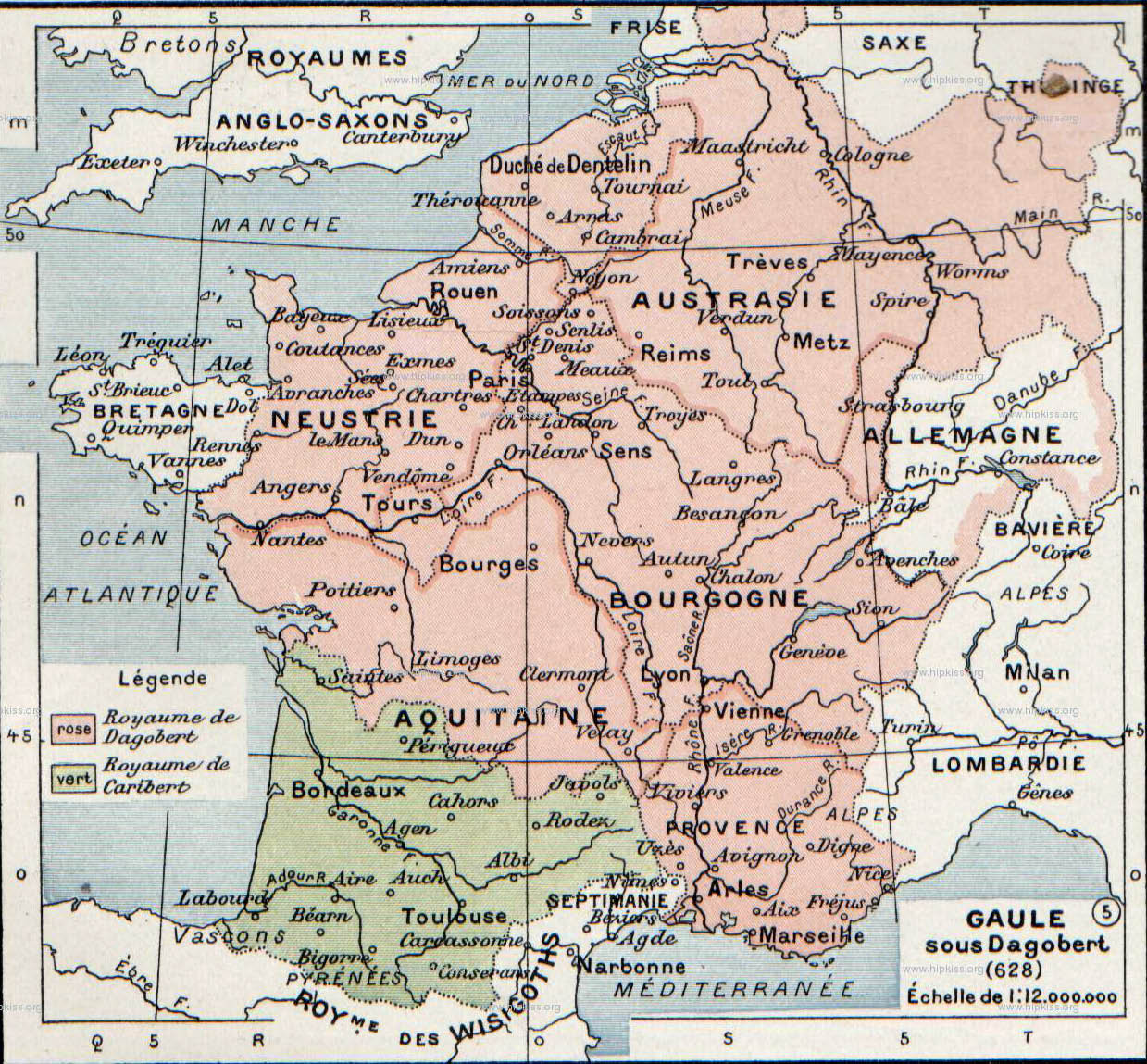
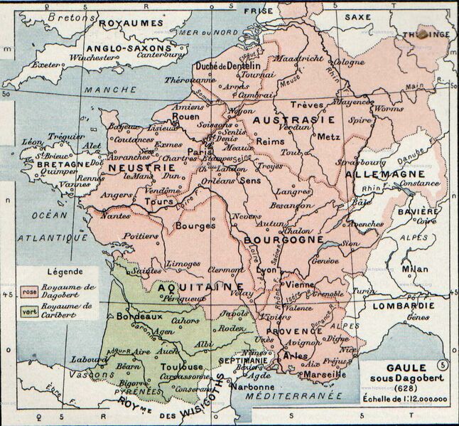
English: The map comes from Vidal-Lablache, Atlas général d'histoire et de géographie (1894). It shows the Frankish kingdoms in 628 AD.
Français : Gaule sous Dagobert (628). Paul Vidal de La Blache, Atlas général d'histoire et de géographie (1894).
|
| ⧼wm-license-information-date⧽ | 1894 |
| ⧼wm-license-information-source⧽ | Paul Vidal de La Blache, Atlas général d'histoire et de géographie (1894). |
| ⧼wm-license-information-author⧽ | صانع:Paul Vidal de La Blache |
ترخيص
قالب:Original upload log
قالب:Original description page
- 2007-08-19 21:37 Srnec 1239×1149×8 (363198 bytes) The map comes from Vidal-Lablache, ''Atlas général d'histoire et de géographie'' (1894). {{PD-art-life-70}}
تاريخ الملف
اضغط على زمن/تاريخ لرؤية الملف كما بدا في هذا الزمن.
| زمن/تاريخ | صورة مصغرة | الأبعاد | مستخدم | تعليق | |
|---|---|---|---|---|---|
| حالي | ★ مراجعة معتمدة 00:09، 19 ديسمبر 2023 | | 1٬239 × 1٬149 (355 كيلوبايت) | Pastakhov (نقاش | مساهمات) | Upload https://upload.wikimedia.org/wikipedia/commons/d/d1/Frankish_kingdoms_in_628.jpg |
لا يمكنك استبدال هذا الملف.
وصلات
لا يوجد صفحات تصل لهذه الصورة.