ملف:Fossaregiafossatumafricaemap.png
لا توجد دقة أعلى متوفرة.
Fossaregiafossatumafricaemap.png (727 × 503 بكسل حجم الملف: 79 كيلوبايت، نوع MIME: image/png)
وصف قصير
| ⧼wm-license-information-description⧽ | |
| ⧼wm-license-information-date⧽ | 2015 |
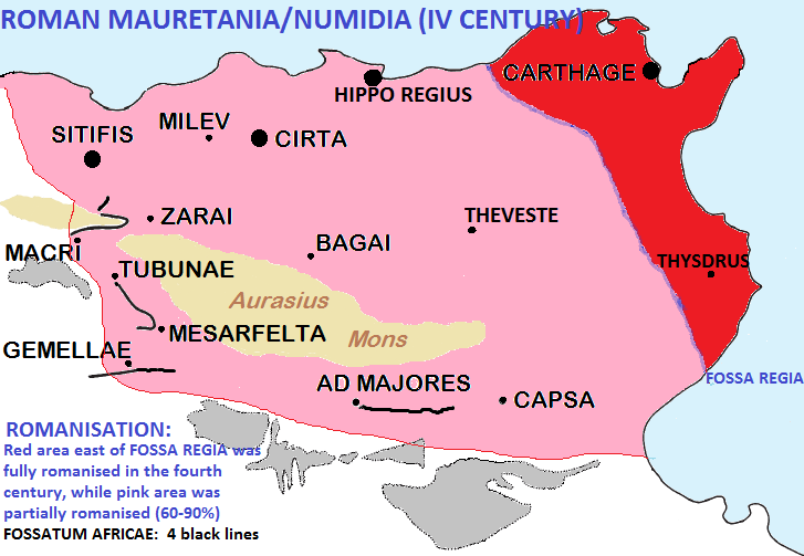
| ⧼wm-license-information-source⧽ | English: I have used a Commons map (File:Fossatum.png) and wrote on it some data with my software. I have added colors in order to define the areas of romanisation in Numidia and Mauretania. |
| ⧼wm-license-information-author⧽ | Cresthaven |
ترخيص
|
تاريخ الملف
اضغط على زمن/تاريخ لرؤية الملف كما بدا في هذا الزمن.
| زمن/تاريخ | صورة مصغرة | الأبعاد | مستخدم | تعليق | |
|---|---|---|---|---|---|
| حالي | ★ مراجعة معتمدة 14:25، 10 نوفمبر 2023 | | 727 × 503 (79 كيلوبايت) | Pastakhov (نقاش | مساهمات) | Upload https://upload.wikimedia.org/wikipedia/commons/7/75/Fossaregiafossatumafricaemap.png |
لا يمكنك استبدال هذا الملف.
وصلات
لا يوجد صفحات تصل لهذه الصورة.