ملف:Folketingsvalget 2022 - Afstemningsområder.svg

حجم معاينة PNG لذلك الملف ذي الامتداد SVG: 510 × 412 بكسل. البعد الآخر: 2٬535 × 2٬048 بكسل.
الملف الأصلي (ملف SVG، أبعاده 510 × 412 بكسل، حجم الملف: 4٫25 ميجابايت)
وصف قصير
| ⧼wm-license-information-description⧽ |
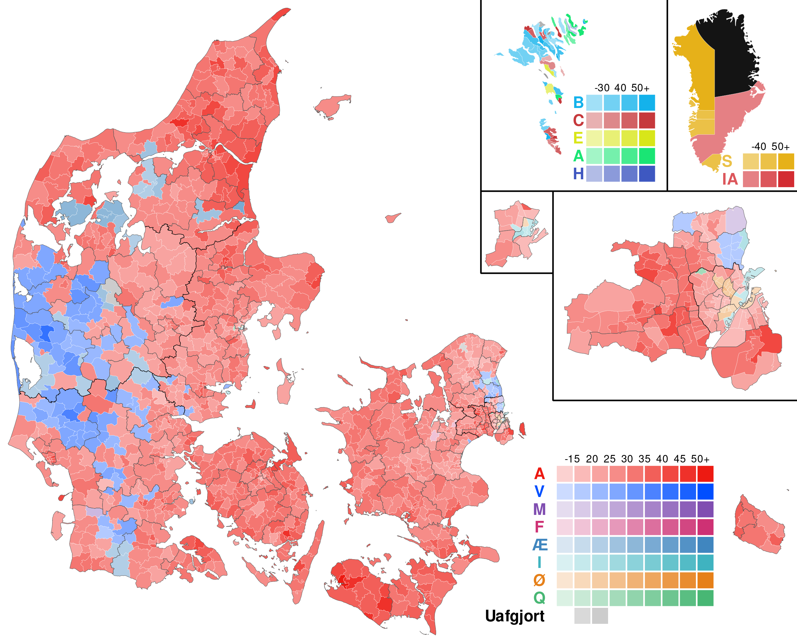
English: A map showing the results of the 2022 Danish election within each polling area. The map shows the share of the vote won by the largest party. The black boundaries show the borders of the nomination districts. In the Faroe Islands and Greenland, the results are shown by municipality.
(Danish) Svenska: Resultat i Folketingsvalet 2022. Kartan visar vilket parti som fått flest röster i respektive valkrets, samt andelen röster partiet fick. Resultaten för Färöarna och Grönland redovisas per kommun.
|
| ⧼wm-license-information-date⧽ | 2022 |
| ⧼wm-license-information-source⧽ | ⧼Wm-license-own-work⧽ |
| ⧼wm-license-information-author⧽ | Gust Justice |
ترخيص
|
تاريخ الملف
اضغط على زمن/تاريخ لرؤية الملف كما بدا في هذا الزمن.
| زمن/تاريخ | صورة مصغرة | الأبعاد | مستخدم | تعليق | |
|---|---|---|---|---|---|
| حالي | ★ مراجعة معتمدة 21:01، 8 أكتوبر 2023 | | 510 × 412 (4٫25 ميجابايت) | Pastakhov (نقاش | مساهمات) | Upload https://upload.wikimedia.org/wikipedia/commons/9/93/Folketingsvalget_2022_-_Afstemningsomr%C3%A5der.svg |
لا يمكنك استبدال هذا الملف.
وصلات
لا يوجد صفحات تصل لهذه الصورة.