ملف:Fllairportmap.png
حجم هذه المعاينة: 598 × 600 بكسل. البعد الآخر: 1٬000 × 1٬003 بكسل.
الملف الأصلي (1٬000 × 1٬003 بكسل حجم الملف: 535 كيلوبايت، نوع MIME: image/png)
وصف قصير
| ⧼wm-license-information-description⧽ |
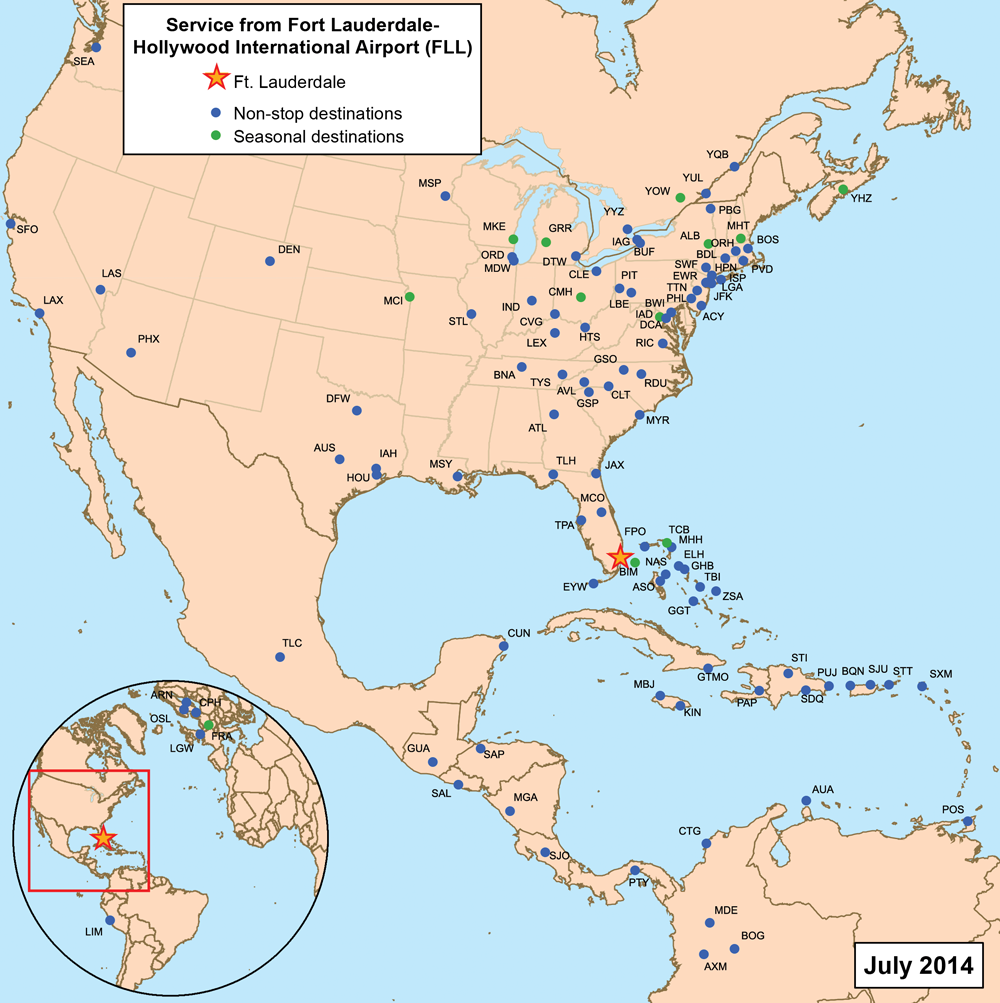
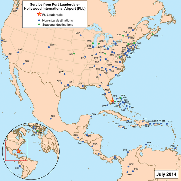
This is a route map for Fort Lauderdale-Hollywood International Airport as of May 2010. Map is an Azimuthal equidistant projection centered on the airport so straight lines from Fort Lauderdale are along great circle routes. Source. |
| ⧼wm-license-information-date⧽ | قالب:Original upload date |
| ⧼wm-license-information-source⧽ | No machine-readable source provided. Own work assumed (based on copyright claims). |
| ⧼wm-license-information-author⧽ | No machine-readable author provided. Kmusser assumed (based on copyright claims). |
ترخيص
|
تاريخ الملف
اضغط على زمن/تاريخ لرؤية الملف كما بدا في هذا الزمن.
| زمن/تاريخ | صورة مصغرة | الأبعاد | مستخدم | تعليق | |
|---|---|---|---|---|---|
| حالي | ★ مراجعة معتمدة 16:03، 23 يناير 2024 | | 1٬000 × 1٬003 (535 كيلوبايت) | Pastakhov (نقاش | مساهمات) | Upload https://upload.wikimedia.org/wikipedia/commons/2/20/Fllairportmap.png |
لا يمكنك استبدال هذا الملف.
وصلات
لا يوجد صفحات تصل لهذه الصورة.