ملف:First satellite photo - Explorer VI.jpg
حجم هذه المعاينة: 440 × 600 بكسل. البعد الآخر: 2٬212 × 3٬016 بكسل.
الملف الأصلي (2٬212 × 3٬016 بكسل حجم الملف: 3٫46 ميجابايت، نوع MIME: image/jpeg)
وصف قصير
| ⧼wm-license-information-description⧽ |
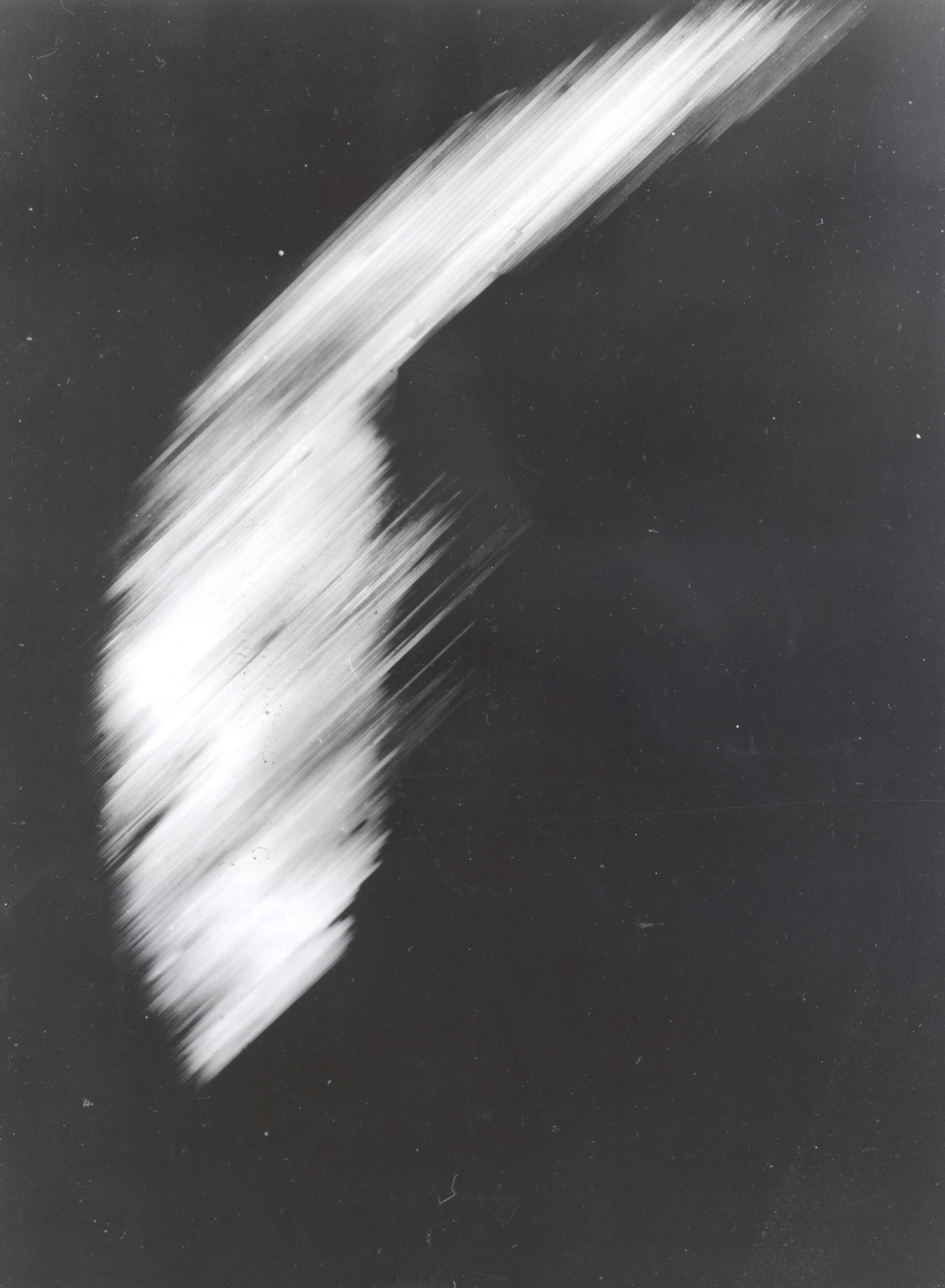
The first photo of Earth from a satellite in orbit. This is the first crude picture obtained from Explorer VI Earth satellite launched August 7, 1959. It shows a sun-lighted area of the Central Pacific ocean and its cloud cover. The picture was made when the satellite was about 17,000 miles above the surface of the earth on August 14, 1959. At the time, the satellite was crossing Mexico. The signals were received at the South Point, Hawaii, tracking station. |
| ⧼wm-license-information-date⧽ | 1959 |
| ⧼wm-license-information-source⧽ | http://grin.hq.nasa.gov/ABSTRACTS/GPN-2002-000200.html |
| ⧼wm-license-information-author⧽ | NASA, Explorer VI satellite |
| ⧼wm-license-information-permission⧽ (⧼wm-license-information-permission-reusing-text⧽) |
Public domain |
ترخيص
تاريخ الملف
اضغط على زمن/تاريخ لرؤية الملف كما بدا في هذا الزمن.
| زمن/تاريخ | صورة مصغرة | الأبعاد | مستخدم | تعليق | |
|---|---|---|---|---|---|
| حالي | ★ مراجعة معتمدة 22:09، 22 نوفمبر 2023 | | 2٬212 × 3٬016 (3٫46 ميجابايت) | Pastakhov (نقاش | مساهمات) | Upload https://upload.wikimedia.org/wikipedia/commons/f/fd/First_satellite_photo_-_Explorer_VI.jpg |
لا يمكنك استبدال هذا الملف.
وصلات
لا يوجد صفحات تصل لهذه الصورة.