ملف:Faroe Islands, Streymoy, Kaldbaksbotnur.jpg

حجم هذه المعاينة: 800 × 531 بكسل. البعد الآخر: 1٬501 × 997 بكسل.
الملف الأصلي (1٬501 × 997 بكسل حجم الملف: 784 كيلوبايت، نوع MIME: image/jpeg)
وصف قصير
| ⧼wm-license-information-description⧽ |
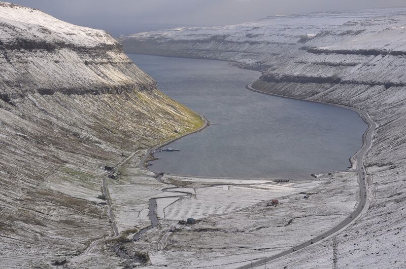
English: Faroe Islands, Streymoy, mouth of the Fjarđará river into Kaldbaksfjørđur at the hamlet of Kaldbaksbotnur in October. On the right the main road into Torshavn.
(Dutch) |
| ⧼wm-license-information-date⧽ | 2010 |
| ⧼wm-license-information-source⧽ | ⧼Wm-license-own-work⧽ |
| ⧼wm-license-information-author⧽ | Vincent van Zeijst |
•62°4′26.94″N 6°56′55.87″W / 62.0741500°N 6.9488528°W
ترخيص
|
تاريخ الملف
اضغط على زمن/تاريخ لرؤية الملف كما بدا في هذا الزمن.
| زمن/تاريخ | صورة مصغرة | الأبعاد | مستخدم | تعليق | |
|---|---|---|---|---|---|
| حالي | ★ مراجعة معتمدة 06:13، 14 أكتوبر 2023 | | 1٬501 × 997 (784 كيلوبايت) | Pastakhov (نقاش | مساهمات) | Upload https://upload.wikimedia.org/wikipedia/commons/9/9a/Faroe_Islands%2C_Streymoy%2C_Kaldbaksbotnur.jpg |
لا يمكنك استبدال هذا الملف.
وصلات
لا يوجد صفحات تصل لهذه الصورة.