ملف:Farmland, Manor Valley - geograph.org.uk - 198958.jpg
لا توجد دقة أعلى متوفرة.
Farmland,_Manor_Valley_-_geograph.org.uk_-_198958.jpg (640 × 478 بكسل حجم الملف: 60 كيلوبايت، نوع MIME: image/jpeg)
وصف قصير
| ⧼wm-license-information-description⧽ |
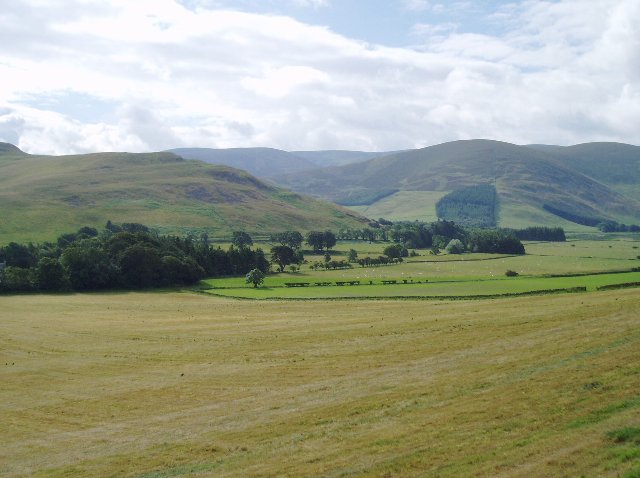
English: Farmland, Manor Valley. These fields slope down to the river, the Manor Water. In the middle distance are, on the left, the south-western slope of Cademuir Hill and, on the right, Canada Hill.
|
| ⧼wm-license-information-date⧽ | 2006 |
| ⧼wm-license-information-source⧽ | From geograph.org.uk |
| ⧼wm-license-information-author⧽ | Eileen Henderson |
| ⧼wm-license-cc-attribution⧽ (قالب:I18n/Credit line) |
Eileen Henderson / Farmland, Manor Valley / |
55°37′37″N 3°15′07″W / 55.6269°N 3.252°W قالب:Object location
_heading:157)
ترخيص
تاريخ الملف
اضغط على زمن/تاريخ لرؤية الملف كما بدا في هذا الزمن.
| زمن/تاريخ | صورة مصغرة | الأبعاد | مستخدم | تعليق | |
|---|---|---|---|---|---|
| حالي | ★ مراجعة معتمدة 01:44، 13 أكتوبر 2023 | | 640 × 478 (60 كيلوبايت) | Pastakhov (نقاش | مساهمات) | Upload https://upload.wikimedia.org/wikipedia/commons/0/0b/Farmland%2C_Manor_Valley_-_geograph.org.uk_-_198958.jpg |
لا يمكنك استبدال هذا الملف.
وصلات
لا يوجد صفحات تصل لهذه الصورة.