ملف:Eswatini, administrative divisions - de - colored.svg

حجم معاينة PNG لذلك الملف ذي الامتداد SVG: 488 × 599 بكسل. البعد الآخر: 1٬667 × 2٬048 بكسل.
الملف الأصلي (ملف SVG، أبعاده 604 × 742 بكسل، حجم الملف: 61 كيلوبايت)
وصف قصير
| ⧼wm-license-information-description⧽ |
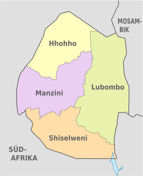
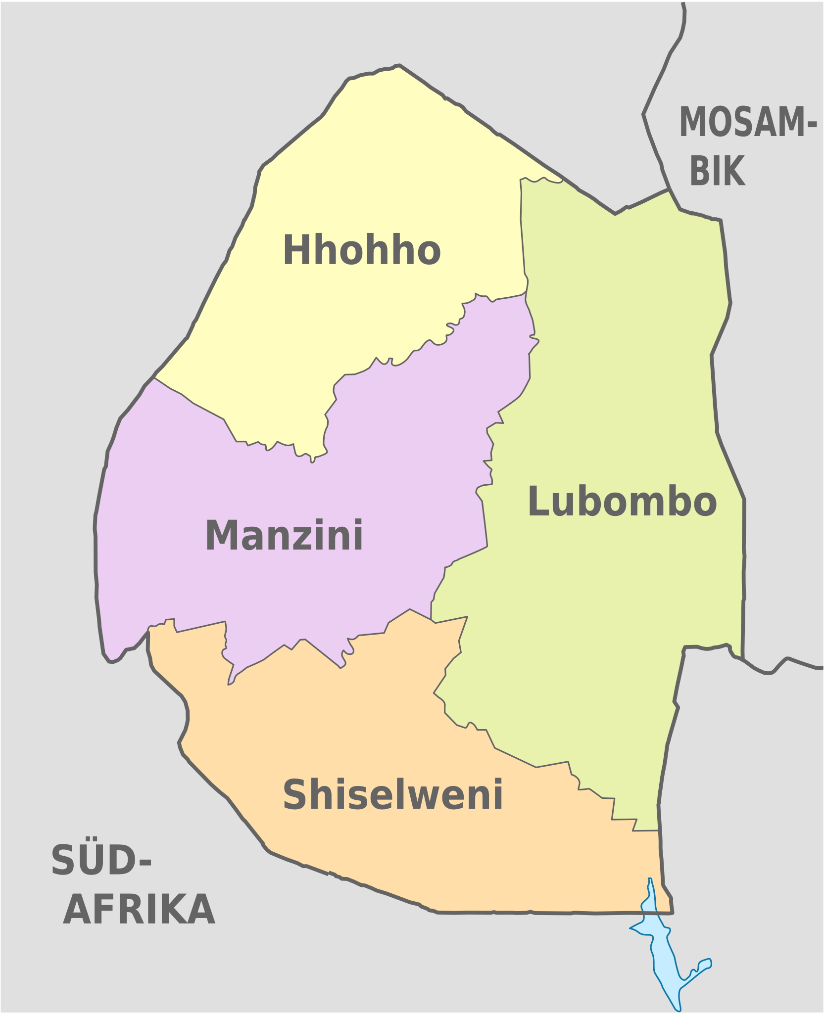
Deutsch: Karte der politischen Gliederung von Eswatini
English: Map of administrative divisions of Eswatini
|
| ⧼wm-license-information-date⧽ | 2012 |
| ⧼wm-license-information-source⧽ | ⧼Wm-license-own-work⧽قالب:Adobe Illustratorقالب:Commonistقالب:AttribSVG |
| ⧼wm-license-information-author⧽ | قالب:TUBS |
| ⧼wm-license-information-other-versions⧽ |
قالب:DerivativeVersions قالب:SVG labeled maps of administrative divisions (location map scheme) |
ترخيص
|

تاريخ الملف
اضغط على زمن/تاريخ لرؤية الملف كما بدا في هذا الزمن.
| زمن/تاريخ | صورة مصغرة | الأبعاد | مستخدم | تعليق | |
|---|---|---|---|---|---|
| حالي | ★ مراجعة معتمدة 16:44، 23 نوفمبر 2023 | | 604 × 742 (61 كيلوبايت) | Pastakhov (نقاش | مساهمات) | Upload https://upload.wikimedia.org/wikipedia/commons/c/c6/Eswatini%2C_administrative_divisions_-_de_-_colored.svg |
لا يمكنك استبدال هذا الملف.
وصلات
لا يوجد صفحات تصل لهذه الصورة.
معلومات الصورة (ميتا)
تصنيفات:
- Self-published work
- SVG labeled maps of administrative divisions of Eswatini (location map scheme)
- SVG labeled maps of administrative divisions of countries of Africa (location map scheme) (german)
- SVG labeled maps of administrative divisions of countries of Africa (location map scheme) (colored scheme)
- Locator maps of Eswatini