ملف:Essex 2.svg

حجم معاينة PNG لذلك الملف ذي الامتداد SVG: 800 × 549 بكسل. البعد الآخر: 2٬560 × 1٬758 بكسل.
الملف الأصلي (ملف SVG، أبعاده 1٬420 × 975 بكسل، حجم الملف: 748 كيلوبايت)
وصف قصير
| ⧼wm-license-information-description⧽ |
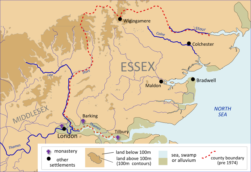
English: A map of Anglo-Saxon Essex and Middlesex, made using File:River Thames and surroudings 2-fr.svg and David Hill, An Atlas of Anglo-Saxon England (1981). قالب:Translation possible
|
| ⧼wm-license-information-date⧽ | 2012 |
| ⧼wm-license-information-source⧽ | ⧼Wm-license-own-work⧽ |
| ⧼wm-license-information-author⧽ | Hel-hama |
ترخيص
|
تاريخ الملف
اضغط على زمن/تاريخ لرؤية الملف كما بدا في هذا الزمن.
| زمن/تاريخ | صورة مصغرة | الأبعاد | مستخدم | تعليق | |
|---|---|---|---|---|---|
| حالي | ★ مراجعة معتمدة 16:34، 13 ديسمبر 2023 | | 1٬420 × 975 (748 كيلوبايت) | Pastakhov (نقاش | مساهمات) | Upload https://upload.wikimedia.org/wikipedia/commons/0/02/Essex_2.svg |
لا يمكنك استبدال هذا الملف.
وصلات
لا يوجد صفحات تصل لهذه الصورة.