ملف:Erf Main catchment.png
حجم هذه المعاينة: 701 × 600 بكسل. البعد الآخر: 1٬686 × 1٬443 بكسل.
الملف الأصلي (1٬686 × 1٬443 بكسل حجم الملف: 1٫3 ميجابايت، نوع MIME: image/png)
وصف قصير
| ⧼wm-license-information-description⧽ |
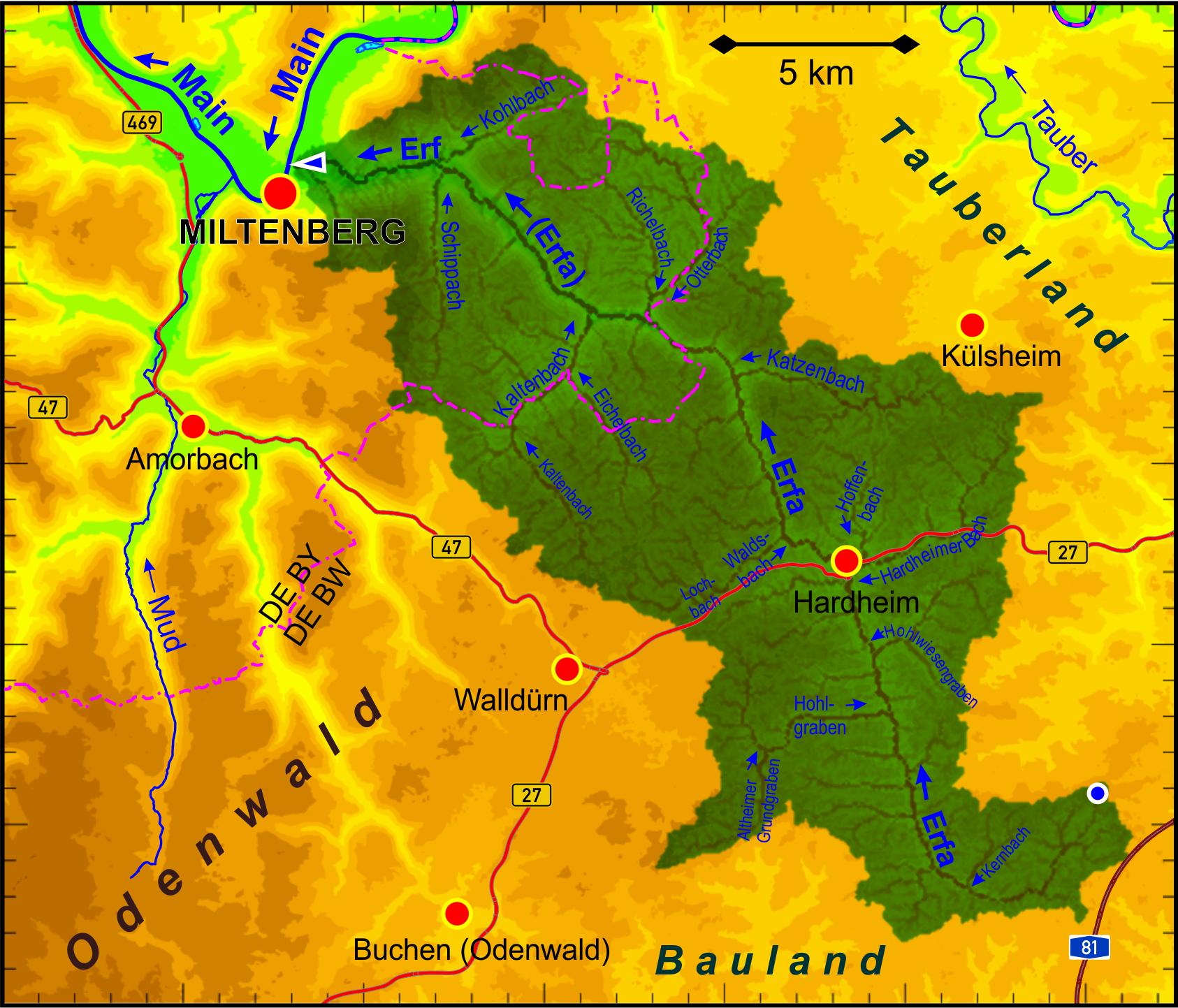
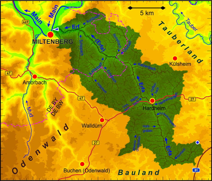
Deutsch: Einzugsgebiet der Erf (Nebenfluss des Mains), hervorgehoben dargestellt, und Topografie (räumliche Auflösung 35 m, Höhenstufen 50 m).
English: Catchment area of the Erf river (tributary of the Main river) emphasized, and the terrain elevation (spatial resolution 35 m and elevation increments of 50 m).
|
| ⧼wm-license-information-date⧽ | 2022 |
| ⧼wm-license-information-source⧽ | ⧼Wm-license-own-work⧽ |
| ⧼wm-license-information-author⧽ | Periphrastika |
Own work based on ASTER Digital Elevation Model data by https://lpdaac.usgs.gov/ and own runoff calculation. Geographical data provided by OpenStreetMap and contributors.
ترخيص
|
تاريخ الملف
اضغط على زمن/تاريخ لرؤية الملف كما بدا في هذا الزمن.
| زمن/تاريخ | صورة مصغرة | الأبعاد | مستخدم | تعليق | |
|---|---|---|---|---|---|
| حالي | ★ مراجعة معتمدة 20:08، 9 ديسمبر 2023 | | 1٬686 × 1٬443 (1٫3 ميجابايت) | Pastakhov (نقاش | مساهمات) | Upload https://upload.wikimedia.org/wikipedia/commons/7/73/Erf_Main_catchment.png |
لا يمكنك استبدال هذا الملف.
وصلات
لا يوجد صفحات تصل لهذه الصورة.