ملف:Envisat captures the Orange River ESA230174.jpg

حجم هذه المعاينة: 748 × 600 بكسل. البعدان الآخران: 2٬554 × 2٬048 بكسل | 3٬189 × 2٬557 بكسل.
الملف الأصلي (3٬189 × 2٬557 بكسل حجم الملف: 1٫75 ميجابايت، نوع MIME: image/jpeg)
وصف قصير
| ⧼wm-license-information-description⧽ |
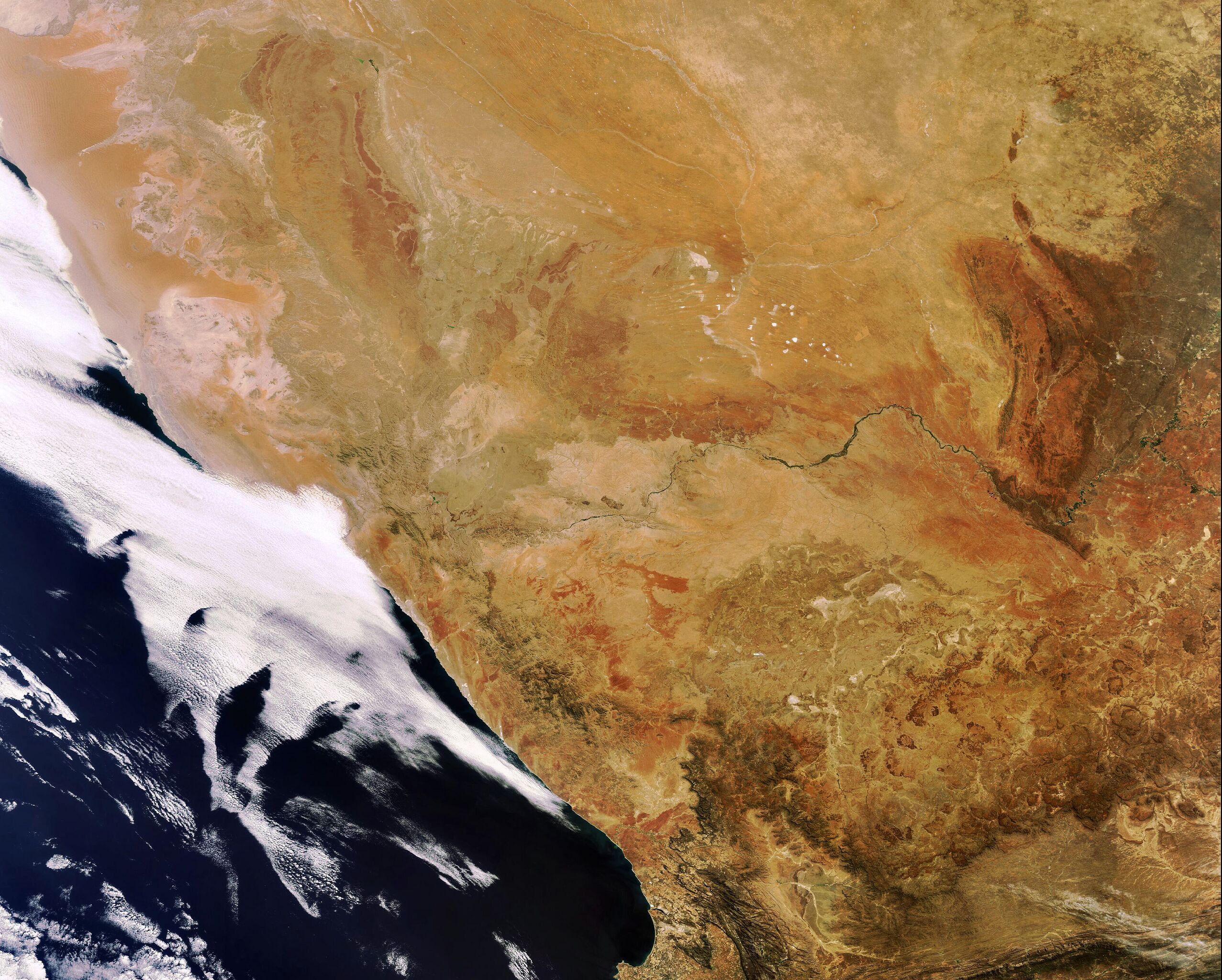
English: Envisat captures the Orange River in Southwest Africa. Rising in the Drakensberg mountains near the South Africa (visible south of the river) and Lesotho border, the Orange River runs westward for 2200 km forming part of the border between South Africa and Namibia (visible north of the river).
Image acquired 12 October 2007 by the MERIS (Medium Resolution Imaging Spectrometer) instrument aboard ESA’s Envisat satellite.
|
| ⧼wm-license-information-date⧽ | 2007 |
| ⧼wm-license-information-source⧽ | http://www.esa.int/spaceinimages/Images/2007/10/Envisat_captures_the_Orange_River |
| ⧼wm-license-information-author⧽ | European Space Agency |
| ⧼wm-license-information-permission⧽ (⧼wm-license-information-permission-reusing-text⧽) |
ESA,CC BY-SA 3.0 IGO |
| ⧼wm-license-information-other-versions⧽ |
|
| Title | Envisat captures the Orange River |
| Keywords | Water (fresh); Rivers |
| Set | Earth observation image of the week |
| Mission | Envisat |
| Activity | Observing the Earth |
ترخيص
تاريخ الملف
اضغط على زمن/تاريخ لرؤية الملف كما بدا في هذا الزمن.
| زمن/تاريخ | صورة مصغرة | الأبعاد | مستخدم | تعليق | |
|---|---|---|---|---|---|
| حالي | ★ مراجعة معتمدة 00:27، 26 أكتوبر 2023 | | 3٬189 × 2٬557 (1٫75 ميجابايت) | Pastakhov (نقاش | مساهمات) | Upload https://upload.wikimedia.org/wikipedia/commons/9/9e/Envisat_captures_the_Orange_River_ESA230174.jpg |
لا يمكنك استبدال هذا الملف.
وصلات
لا يوجد صفحات تصل لهذه الصورة.