ملف:EnglandCentralBedfordshire.png
لا توجد دقة أعلى متوفرة.
EnglandCentralBedfordshire.png (200 × 247 بكسل حجم الملف: 25 كيلوبايت، نوع MIME: image/png)
| ⧼wm-license-information-description⧽ |
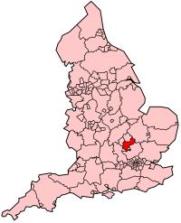
Map showing location of Central Bedfordshire Unitary Authority (effective 1st April 2009) in England. |
| ⧼wm-license-information-date⧽ | 2009 |
| ⧼wm-license-information-source⧽ | Own work, derived from File:BlankMap-EnglandSubdivisions2009.png. |
| ⧼wm-license-information-author⧽ | Keith Edkins |
ترخيص
تاريخ الملف
اضغط على زمن/تاريخ لرؤية الملف كما بدا في هذا الزمن.
| زمن/تاريخ | صورة مصغرة | الأبعاد | مستخدم | تعليق | |
|---|---|---|---|---|---|
| حالي | ★ مراجعة معتمدة 11:53، 12 نوفمبر 2023 | | 200 × 247 (25 كيلوبايت) | Pastakhov (نقاش | مساهمات) | Upload https://upload.wikimedia.org/wikipedia/commons/e/ec/EnglandCentralBedfordshire.png |
لا يمكنك استبدال هذا الملف.
وصلات
لا يوجد صفحات تصل لهذه الصورة.