ملف:England, Northern Ireland, and Wales AONBs map.svg

حجم معاينة PNG لذلك الملف ذي الامتداد SVG: 512 × 516 بكسل. البعد الآخر: 2٬032 × 2٬048 بكسل.
الملف الأصلي (ملف SVG، أبعاده 512 × 516 بكسل، حجم الملف: 2٫01 ميجابايت)
وصف قصير
| ⧼wm-license-information-description⧽ |
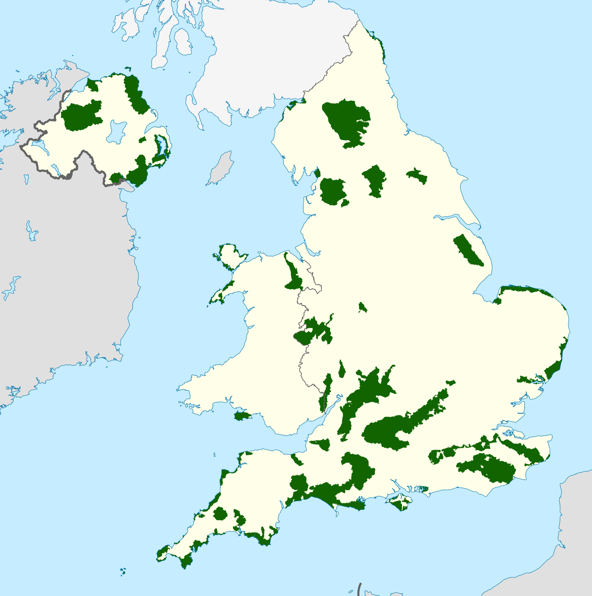
Map showing all of the Areas of Outstanding Natural Beauty of England, Northern Ireland, and Wales, in the United Kingdom. |
||
| ⧼wm-license-information-date⧽ | 2021 | ||
| ⧼wm-license-information-source⧽ | Ordnance Survey OSOpenData Boundary-Line:
OpenData NI Department of Finance NIDirect OpenData
Welsh Government / Natural Resources Wales Lle Geo-Portal
Natural England UK Government (Defra)–Natural England
|
||
| ⧼wm-license-information-author⧽ | Dank · Jay, using Ordnance Survey, Natural Resources Wales, OpenDataNI and Natural England data. قالب:Attribقالب:Attrib | ||
| ⧼wm-license-information-permission⧽ (⧼wm-license-information-permission-reusing-text⧽) |
|
||
| ⧼wm-license-information-other-versions⧽ |
تاريخ الملف
اضغط على زمن/تاريخ لرؤية الملف كما بدا في هذا الزمن.
| زمن/تاريخ | صورة مصغرة | الأبعاد | مستخدم | تعليق | |
|---|---|---|---|---|---|
| حالي | ★ مراجعة معتمدة 11:57، 9 أكتوبر 2023 | | 512 × 516 (2٫01 ميجابايت) | Pastakhov (نقاش | مساهمات) | Upload https://upload.wikimedia.org/wikipedia/commons/b/ba/England%2C_Northern_Ireland%2C_and_Wales_AONBs_map.svg |
لا يمكنك استبدال هذا الملف.
وصلات
لا يوجد صفحات تصل لهذه الصورة.