ملف:Eilean Fhlòdaigearraidh.jpg
لا توجد دقة أعلى متوفرة.
Eilean_Fhlòdaigearraidh.jpg (640 × 480 بكسل حجم الملف: 121 كيلوبايت، نوع MIME: image/jpeg)
وصف قصير
| ⧼wm-license-information-description⧽ |
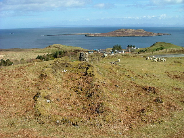
English: Ruined croft building and centenary cairn, near to Flodigarry, Highland, Great Britain.
In 1909 the body set up by the government to assist the crofting population, the Congested Districts Board, who had acquired the land in 1904, divided the township into 14 crofts, providing land and homes for a generation who laid down roots which have survived to this day. The cairn was erected in 2009. |
| ⧼wm-license-information-date⧽ | 2010 |
| ⧼wm-license-information-source⧽ | From this image at geograph.org.uk; transferred by User:RHaworth using geograph_org2commons. |
| ⧼wm-license-information-author⧽ | Dave Fergusson |
| ⧼wm-license-information-permission⧽ (⧼wm-license-information-permission-reusing-text⧽) |
Creative Commons Attribution Share-alike license 2.0 |
| ⧼wm-license-cc-attribution⧽ (قالب:I18n/Credit line) |
Dave Fergusson / Ruined croft building and centenary cairn / |
قالب:Location dec قالب:Object location
ترخيص
تاريخ الملف
اضغط على زمن/تاريخ لرؤية الملف كما بدا في هذا الزمن.
| زمن/تاريخ | صورة مصغرة | الأبعاد | مستخدم | تعليق | |
|---|---|---|---|---|---|
| حالي | ★ مراجعة معتمدة 09:12، 7 نوفمبر 2023 | | 640 × 480 (121 كيلوبايت) | Pastakhov (نقاش | مساهمات) | Upload https://upload.wikimedia.org/wikipedia/commons/b/b8/Eilean_Fhl%C3%B2daigearraidh.jpg |
لا يمكنك استبدال هذا الملف.
وصلات
لا يوجد صفحات تصل لهذه الصورة.