ملف:Eastern Chagatai 1372.jpg
حجم هذه المعاينة: 800 × 544 بكسل. البعد الآخر: 1٬103 × 750 بكسل.
الملف الأصلي (1٬103 × 750 بكسل حجم الملف: 190 كيلوبايت، نوع MIME: image/jpeg)
وصف قصير
| ⧼wm-license-information-description⧽ |
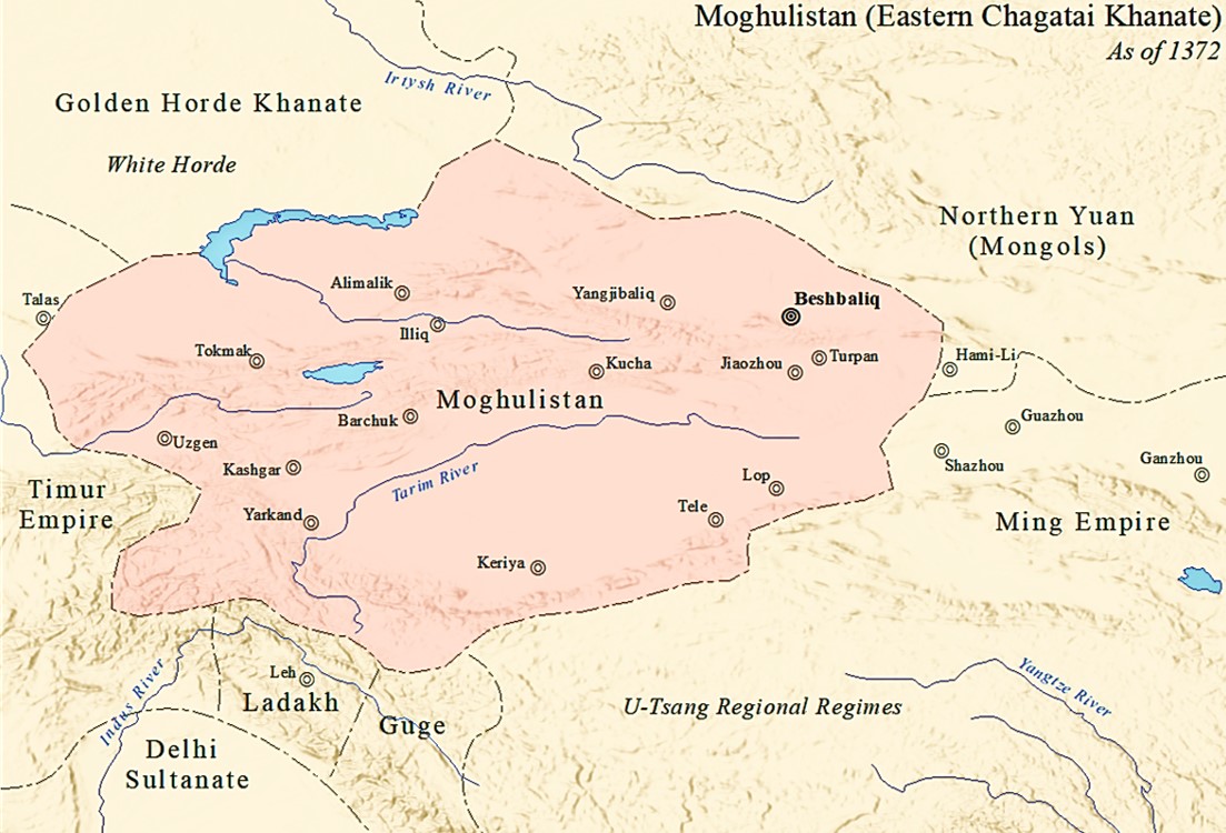
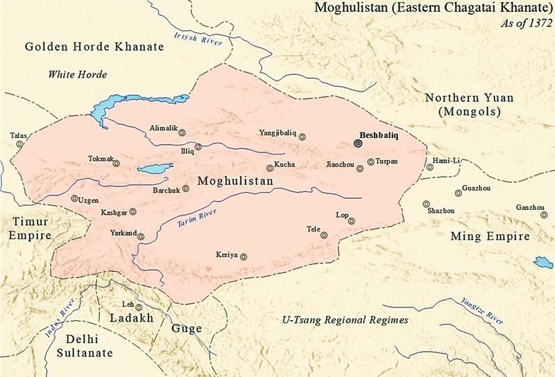
English: The map showing the Eastern Chagatai Khanate (Moghulistan) as of the year 1372 AD.
صينية: 1372年东察合台汗国地图 |
| ⧼wm-license-information-date⧽ | 2018 |
| ⧼wm-license-information-source⧽ | ⧼Wm-license-own-work⧽ |
| ⧼wm-license-information-author⧽ | SY |
Ref: The Historical Atlas of China by Tan Qixiang (1987)
ترخيص
|
تاريخ الملف
اضغط على زمن/تاريخ لرؤية الملف كما بدا في هذا الزمن.
| زمن/تاريخ | صورة مصغرة | الأبعاد | مستخدم | تعليق | |
|---|---|---|---|---|---|
| حالي | ★ مراجعة معتمدة 03:48، 6 أكتوبر 2023 | | 1٬103 × 750 (190 كيلوبايت) | Pastakhov (نقاش | مساهمات) | Upload https://upload.wikimedia.org/wikipedia/commons/5/52/Eastern_Chagatai_1372.jpg |
لا يمكنك استبدال هذا الملف.
وصلات
لا يوجد صفحات تصل لهذه الصورة.