ملف:East Hertfordshire UK locator map.svg

حجم معاينة PNG لذلك الملف ذي الامتداد SVG: 800 × 557 بكسل. البعد الآخر: 2٬560 × 1٬782 بكسل.
الملف الأصلي (ملف SVG، أبعاده 1٬425 × 992 بكسل، حجم الملف: 846 كيلوبايت)
| ⧼wm-license-information-description⧽ |
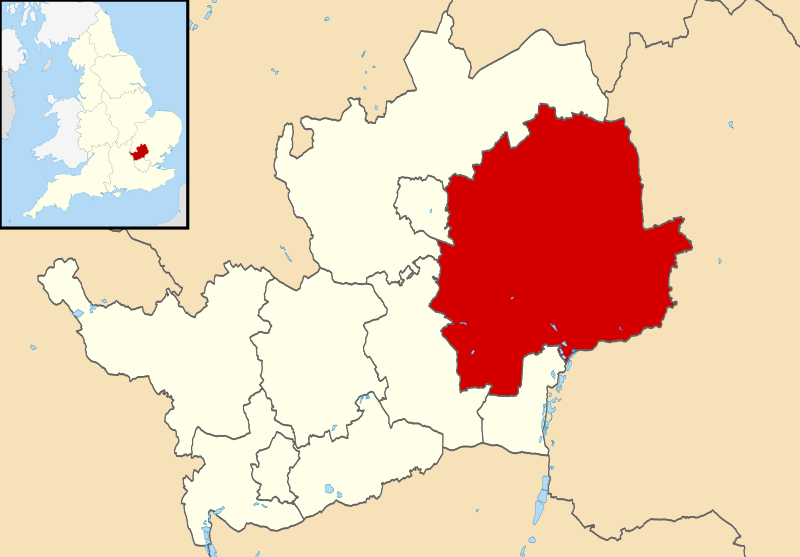
Map of Hertfordshire, UK with East Hertfordshire highlighted. Equirectangular map projection on WGS 84 datum, with N/S stretched 160% |
||
| ⧼wm-license-information-date⧽ | 2011 | ||
| ⧼wm-license-information-source⧽ | Ordnance Survey OpenData
|
||
| ⧼wm-license-information-author⧽ | Nilfanion, created using Ordnance Survey data | ||
| ⧼wm-license-information-permission⧽ (⧼wm-license-information-permission-reusing-text⧽) |
|
|Source=⧼Wm-license-own-work⧽ |Date= |Author= Nilfanion |Permission= |other_versions= }}
تاريخ الملف
اضغط على زمن/تاريخ لرؤية الملف كما بدا في هذا الزمن.
| زمن/تاريخ | صورة مصغرة | الأبعاد | مستخدم | تعليق | |
|---|---|---|---|---|---|
| حالي | ★ مراجعة معتمدة 21:37، 19 نوفمبر 2023 | | 1٬425 × 992 (846 كيلوبايت) | Pastakhov (نقاش | مساهمات) | Upload https://upload.wikimedia.org/wikipedia/commons/8/8e/East_Hertfordshire_UK_locator_map.svg |
لا يمكنك استبدال هذا الملف.
وصلات
لا يوجد صفحات تصل لهذه الصورة.