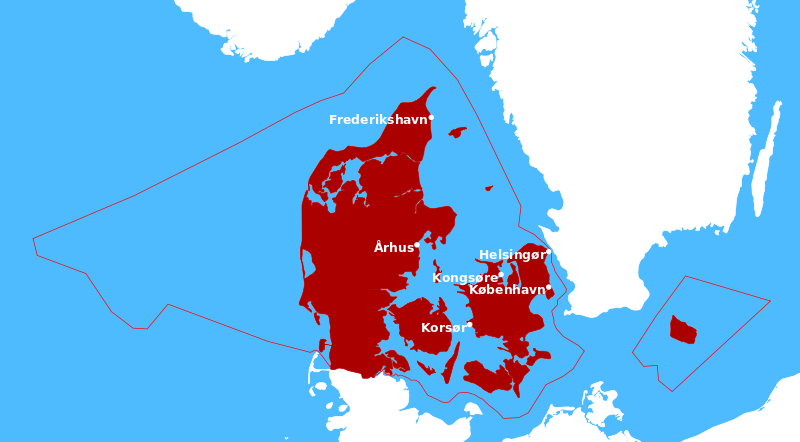
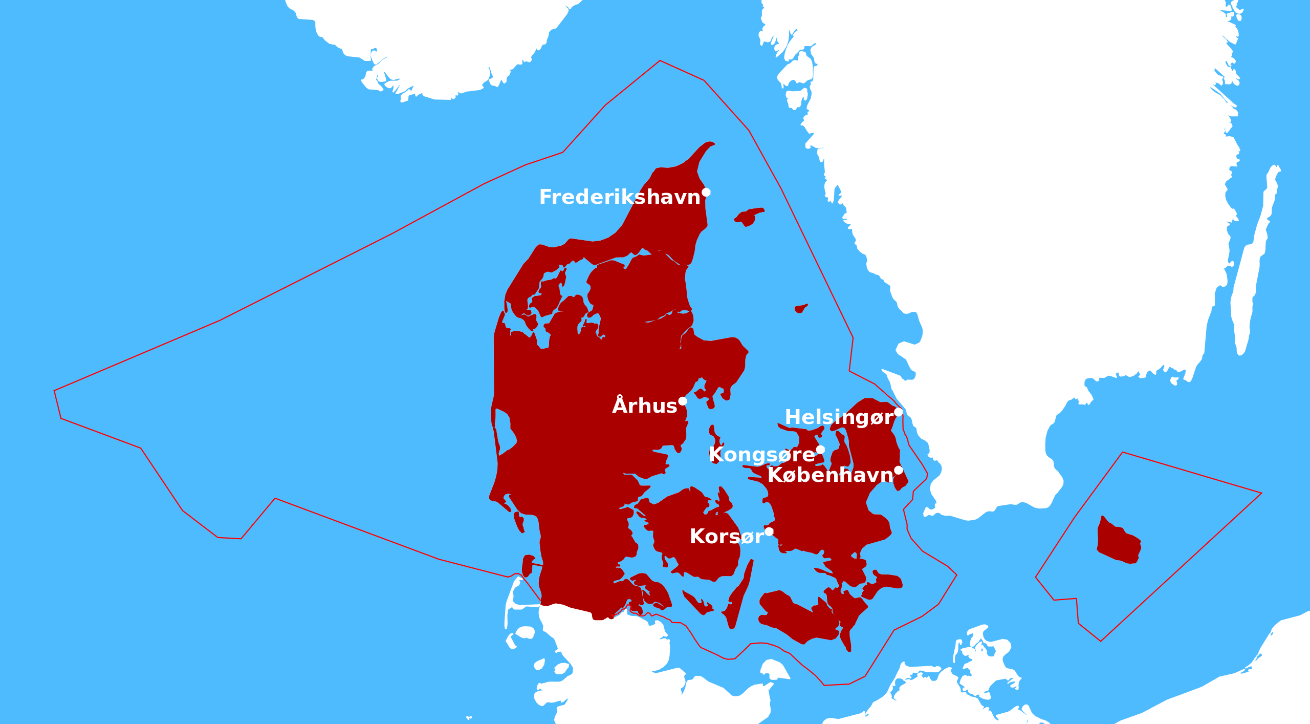
ملف:EEZ of Denmark.svg

حجم معاينة PNG لذلك الملف ذي الامتداد SVG: 800 × 442 بكسل. البعد الآخر: 2٬560 × 1٬414 بكسل.
الملف الأصلي (ملف SVG، أبعاده 1٬052 × 581 بكسل، حجم الملف: 256 كيلوبايت)
| ⧼wm-license-information-description⧽ |
English: Exclusive Economic Zone of Denmark
|
||
| ⧼wm-license-information-date⧽ | 2012 | ||
| ⧼wm-license-information-source⧽ | own work, based on:
|
||
| ⧼wm-license-information-author⧽ |
|
||
| ⧼wm-license-information-permission⧽ (⧼wm-license-information-permission-reusing-text⧽) |
|
تاريخ الملف
اضغط على زمن/تاريخ لرؤية الملف كما بدا في هذا الزمن.
| زمن/تاريخ | صورة مصغرة | الأبعاد | مستخدم | تعليق | |
|---|---|---|---|---|---|
| حالي | ★ مراجعة معتمدة 16:11، 14 نوفمبر 2023 | | 1٬052 × 581 (256 كيلوبايت) | Pastakhov (نقاش | مساهمات) | Upload https://upload.wikimedia.org/wikipedia/commons/e/ef/EEZ_of_Denmark.svg |
لا يمكنك استبدال هذا الملف.
وصلات
لا يوجد صفحات تصل لهذه الصورة.