ملف:DupaxdelNorte,Nueva Vizcayajf7029 15.JPG
حجم هذه المعاينة: 800 × 461 بكسل. البعدان الآخران: 2٬560 × 1٬475 بكسل | 4٬600 × 2٬650 بكسل.
الملف الأصلي (4٬600 × 2٬650 بكسل حجم الملف: 1٫8 ميجابايت، نوع MIME: image/jpeg)
وصف قصير
| ⧼wm-license-information-description⧽ |
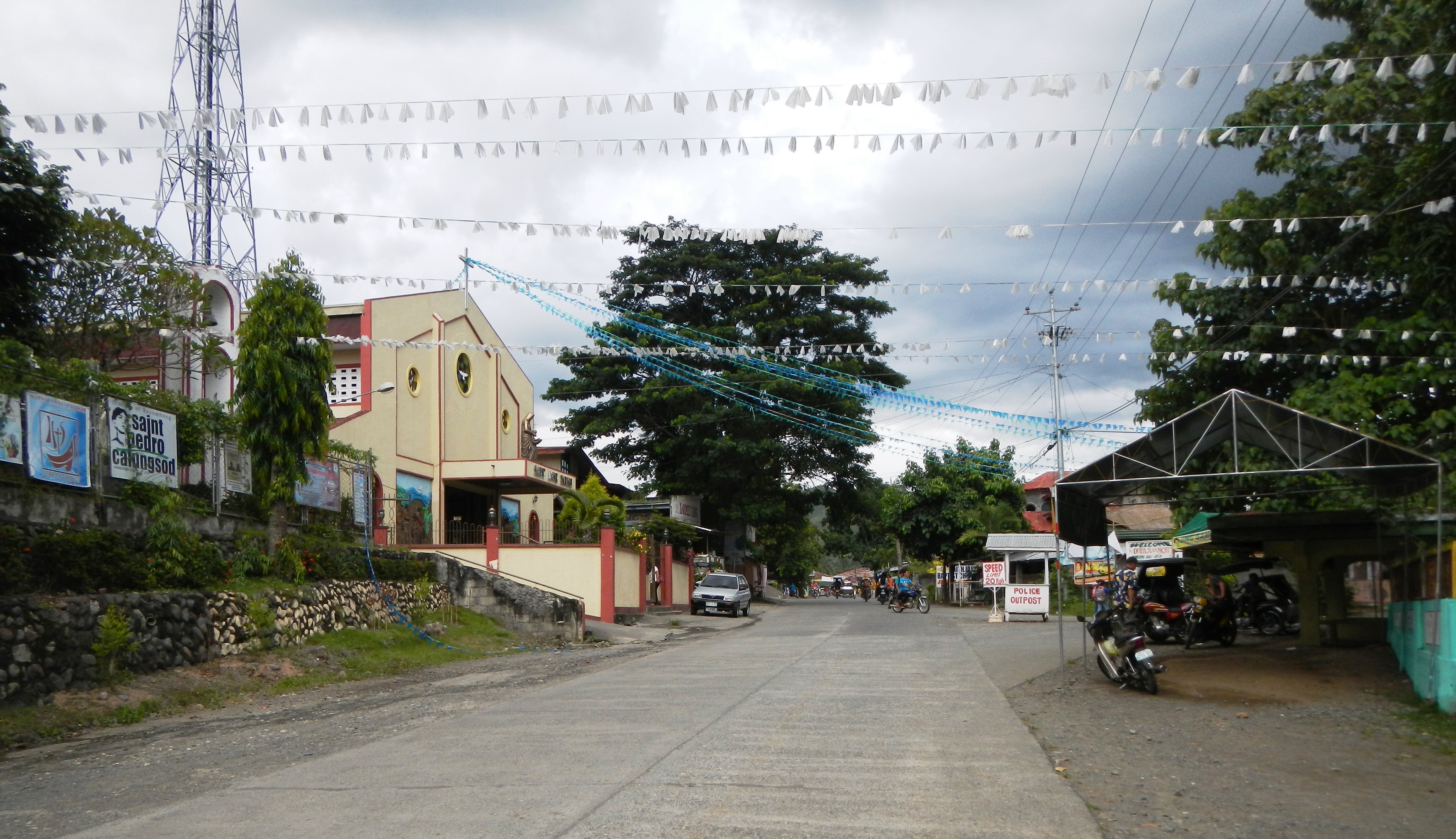
English: UploadWizard photos -- (General description, 3-dimension angle by angle photography of this town, church & landmarks) --Centro, downtown, town centre of Dupax del Norte, Nueva Vizcaya[1] - -- Santa Ana Hall, Scenery and landmarks, Dupax del Norte Central School in front of the Church --- after District Highway Boundary S00879LZ: DM Junction: Malasin Road KO 252+764, the Welcome Sign Boundary of Barangay Lamo to Barangay Malasin and neighbor, Bambang, Nueva Vizcaya ---- Dupax del Norte, Nueva Vizcaya[2] [3] Land Area: 347.30 km² ZIP Code: 3706 a 3rd class municipality in the province of Nueva Vizcaya, [4] Philippines; the latest census, it has a population of 23,196 people in 4,771 households; politically subdivided into 15 barangays: Coordinates: 16°10'52"N 121°12'8"E [5] [6] Coordinates: 16°20'4"N 121°6'33"E Website located along Daang Maharlika or Cagayan Valley Road or Pan-Philippine Highway[7] the only passageway that links the entire North East Luzon to Metro Manila and Central Luzon. Cagayan Valley [8]).
|
| ⧼wm-license-information-date⧽ | 2013, {{time}} – invalid date format 38 (help) |
| ⧼wm-license-information-source⧽ | ⧼Wm-license-own-work⧽ |
| ⧼wm-license-information-author⧽ | Ramon FVelasquez |
ترخيص
|
تاريخ الملف
اضغط على زمن/تاريخ لرؤية الملف كما بدا في هذا الزمن.
| زمن/تاريخ | صورة مصغرة | الأبعاد | مستخدم | تعليق | |
|---|---|---|---|---|---|
| حالي | ★ مراجعة معتمدة 07:45، 11 أكتوبر 2023 | | 4٬600 × 2٬650 (1٫8 ميجابايت) | Pastakhov (نقاش | مساهمات) | Upload https://upload.wikimedia.org/wikipedia/commons/7/75/DupaxdelNorte%2CNueva_Vizcayajf7029_15.JPG |
لا يمكنك استبدال هذا الملف.
وصلات
لا يوجد صفحات تصل لهذه الصورة.