ملف:Duchy of Bohemia locator map (1029).svg

حجم معاينة PNG لذلك الملف ذي الامتداد SVG: 686 × 600 بكسل. البعد الآخر: 2٬342 × 2٬048 بكسل.
الملف الأصلي (ملف SVG، أبعاده 4٬431 × 3٬875 بكسل، حجم الملف: 4٫7 ميجابايت)
وصف قصير
| ⧼wm-license-information-description⧽ |
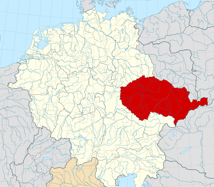
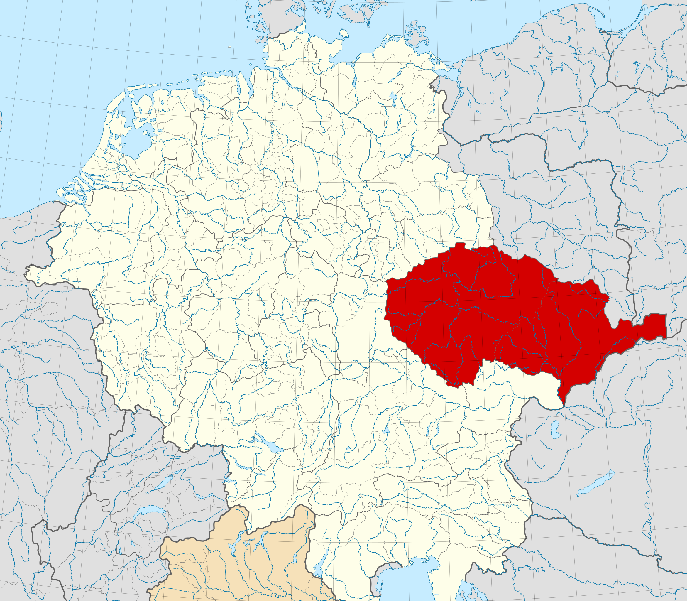
English: Locator map of the Duchy of Bohemia within the Holy Roman Empire (1029).
The Duchy of Bohemia in 1029.
Territories of the Holy Roman Empire.
Territories connected with the Holy Roman Empire
Territories outside the Holy Roman Empire. |
| ⧼wm-license-information-date⧽ | 2019 |
| ⧼wm-license-information-source⧽ | File:Saxony locator map (1000).svg, based on data from File:Droysens-22-23.jpg |
| ⧼wm-license-information-author⧽ | قالب:Own based work by User:Alphathon |
.svg&action=edit&redlink=1)
ترخيص
|
|
هذا العمل مرخّص تحت رخصة المشاع الإبداعي الملزمة بنسبة العمل لمؤلفه وبترخيص الأعمال المشتقة بالمثل 4.0. |
تاريخ الملف
اضغط على زمن/تاريخ لرؤية الملف كما بدا في هذا الزمن.
| زمن/تاريخ | صورة مصغرة | الأبعاد | مستخدم | تعليق | |
|---|---|---|---|---|---|
| حالي | ★ مراجعة معتمدة 11:26، 16 أكتوبر 2023 | | 4٬431 × 3٬875 (4٫7 ميجابايت) | Pastakhov (نقاش | مساهمات) | Upload https://upload.wikimedia.org/wikipedia/commons/5/58/Duchy_of_Bohemia_locator_map_%281029%29.svg |
لا يمكنك استبدال هذا الملف.
وصلات
لا يوجد صفحات تصل لهذه الصورة.
.svg&oldid=3143829)