ملف:Duchy of Austria locator map (1250).svg

حجم معاينة PNG لذلك الملف ذي الامتداد SVG: 800 × 585 بكسل. البعد الآخر: 2٬560 × 1٬871 بكسل.
الملف الأصلي (ملف SVG، أبعاده 3٬120 × 2٬280 بكسل، حجم الملف: 3٫53 ميجابايت)
وصف قصير
|
|
This image was created with Inkscape. |
| ⧼wm-license-information-description⧽ |
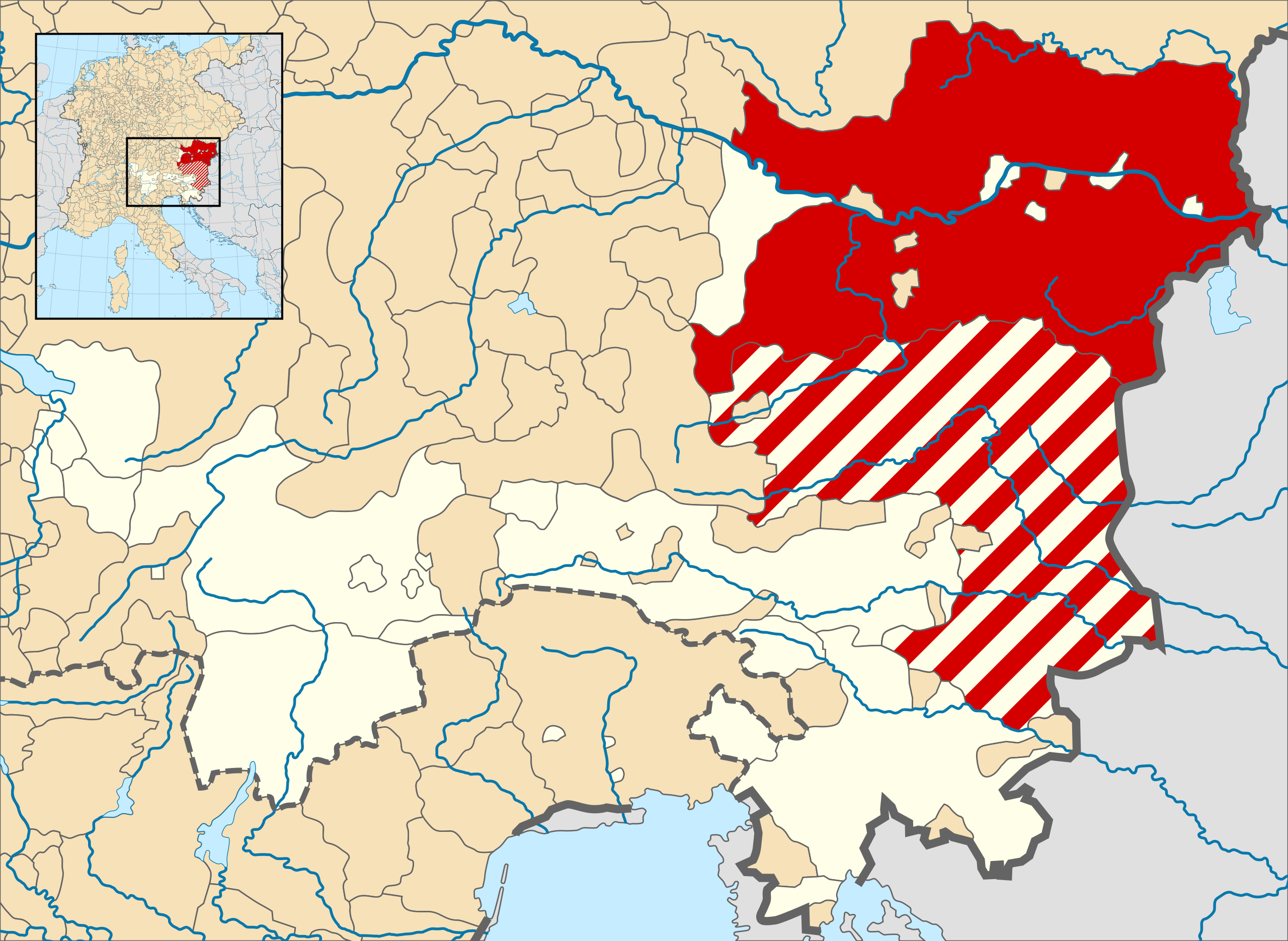
English: A map of the Duchy of Austria (German: Herzogtum Österreich) at the time of the Hohenstaufen Emperors (circa 1250). Austria is shown in solid red while the Duchy of Styria (German: Herzogtum Steiermark or Steyermark), an Austrian possession, is shown in hashed red.
The highlighted area roughly corresponds with the later Austrian Circle. This has no meaning at the time shown and is used only to provide context. Note that while it uses the same scheme as standard location/locator maps, this map technically does not conform to the standard, as it is not in equirectangular projection. Therefore grid lines for latitude and longitude are also included on the sub-map. |
| ⧼wm-license-information-date⧽ | 2016 |
| ⧼wm-license-information-source⧽ | File: own work Data: Droysens-26.jpg |
| ⧼wm-license-information-author⧽ | Alphathon /ˈæɫfə.θɒn/ (talk) |
| ⧼wm-license-information-other-versions⧽ |
ملف:Holy Roman Empire 1250 (location map scheme).svg Location map of the HRE |
.svg)
ترخيص
|
|
هذا العمل مرخّص تحت رخصة المشاع الإبداعي الملزمة بنسبة العمل لمؤلفه وبترخيص الأعمال المشتقة بالمثل 4.0. |
تاريخ الملف
اضغط على زمن/تاريخ لرؤية الملف كما بدا في هذا الزمن.
| زمن/تاريخ | صورة مصغرة | الأبعاد | مستخدم | تعليق | |
|---|---|---|---|---|---|
| حالي | ★ مراجعة معتمدة 20:38، 1 نوفمبر 2023 | | 3٬120 × 2٬280 (3٫53 ميجابايت) | Pastakhov (نقاش | مساهمات) | Upload https://upload.wikimedia.org/wikipedia/commons/4/47/Duchy_of_Austria_locator_map_%281250%29.svg |
لا يمكنك استبدال هذا الملف.
وصلات
لا يوجد صفحات تصل لهذه الصورة.
.svg&oldid=3323488)