ملف:Duchies of Guastalla, Bozzolo and Sabbioneta.png
حجم هذه المعاينة: 800 × 450 بكسل. البعد الآخر: 1٬536 × 864 بكسل.
الملف الأصلي (1٬536 × 864 بكسل حجم الملف: 2٫67 ميجابايت، نوع MIME: image/png)
وصف قصير
| ⧼wm-license-information-description⧽ |
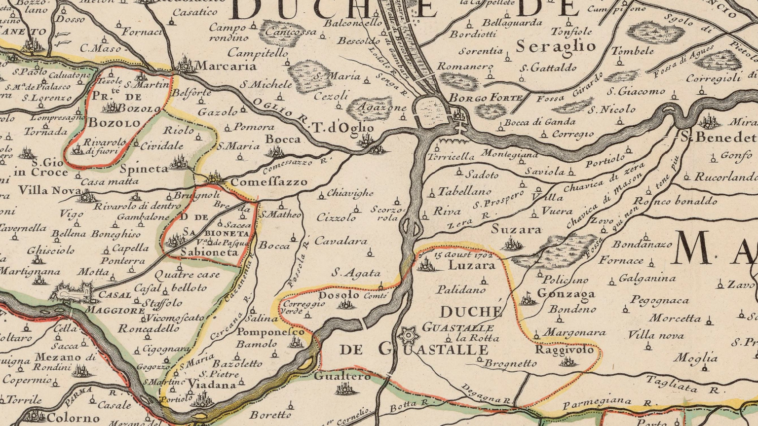
English: The Duchy of Guastalla and region, cropped from a French-language map centered on the course of the Po River published by Placide de Saint-Hélène in 1702. The small principality of Bozzolo and the duchy of Sabbioneta to the northwest of Guastalla also belonged to the Gonzaga family until 1746. The map is titled Le cours du Po, dans le Duché de Mantoue.
Français : Le duché de Guastalle vers 1700. Tiré de la carte de Placide de Saint-Hélène intitulée Le cours du Po, dans le Duché de Mantoue, publiée en 1702. Les deux petits états de Bozzolo et de Sabbioneta, au nord-ouest de Guastalla, appartinrent également à la famille Gonzaga jusqu'en 1746.
|
| ⧼wm-license-information-date⧽ | 1702 |
| ⧼wm-license-information-source⧽ | BnF (Gallica) |
| ⧼wm-license-information-author⧽ | Placide de Saint-Hélène |
ترخيص
|
|
This file is in the ملكية عامة because its copyright has expired in the United States and those countries with a copyright term of no more than the life of the author plus 100 years.
|
تاريخ الملف
اضغط على زمن/تاريخ لرؤية الملف كما بدا في هذا الزمن.
| زمن/تاريخ | صورة مصغرة | الأبعاد | مستخدم | تعليق | |
|---|---|---|---|---|---|
| حالي | ★ مراجعة معتمدة 18:33، 17 أكتوبر 2023 | | 1٬536 × 864 (2٫67 ميجابايت) | Pastakhov (نقاش | مساهمات) | Upload https://upload.wikimedia.org/wikipedia/commons/4/4d/Duchies_of_Guastalla%2C_Bozzolo_and_Sabbioneta.png |
لا يمكنك استبدال هذا الملف.
وصلات
لا يوجد صفحات تصل لهذه الصورة.