ملف:Districts of the Volta Region (2018).png
حجم هذه المعاينة: 499 × 599 بكسل. البعد الآخر: 2٬172 × 2٬607 بكسل.
الملف الأصلي (2٬172 × 2٬607 بكسل حجم الملف: 608 كيلوبايت، نوع MIME: image/png)
وصف قصير
| ⧼wm-license-information-description⧽ |
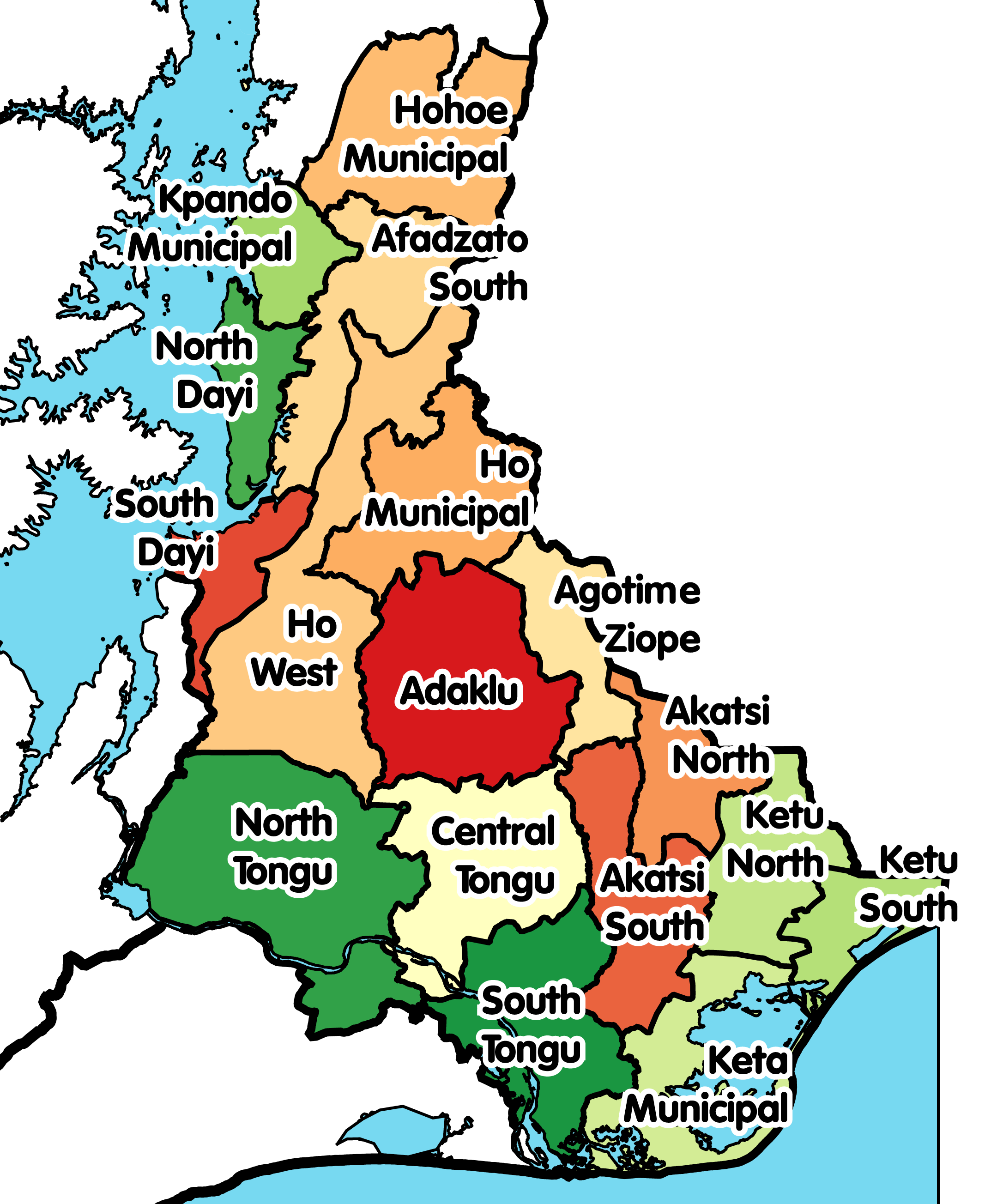
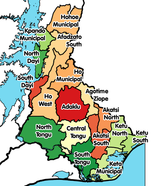
English: Political map of Ghana's Volta Region and its districts after Oti Region was created from it in December 2018.
|
| ⧼wm-license-information-date⧽ | 2019 |
| ⧼wm-license-information-source⧽ | ⧼Wm-license-own-work⧽ |
| ⧼wm-license-information-author⧽ | Rwhaun |
ترخيص
|
تاريخ الملف
اضغط على زمن/تاريخ لرؤية الملف كما بدا في هذا الزمن.
| زمن/تاريخ | صورة مصغرة | الأبعاد | مستخدم | تعليق | |
|---|---|---|---|---|---|
| حالي | ★ مراجعة معتمدة 01:36، 8 ديسمبر 2023 | | 2٬172 × 2٬607 (608 كيلوبايت) | Pastakhov (نقاش | مساهمات) | Upload https://upload.wikimedia.org/wikipedia/commons/9/9b/Districts_of_the_Volta_Region_%282018%29.png |
لا يمكنك استبدال هذا الملف.
وصلات
لا يوجد صفحات تصل لهذه الصورة.
.png&oldid=3721297)