ملف:Districts of Copenhagen municipality 2002-2006.svg

حجم معاينة PNG لذلك الملف ذي الامتداد SVG: 600 × 600 بكسل. البعد الآخر: 2٬048 × 2٬048 بكسل.
الملف الأصلي (ملف SVG، أبعاده 870 × 870 بكسل، حجم الملف: 49 كيلوبايت)
| ⧼wm-license-information-description⧽ |
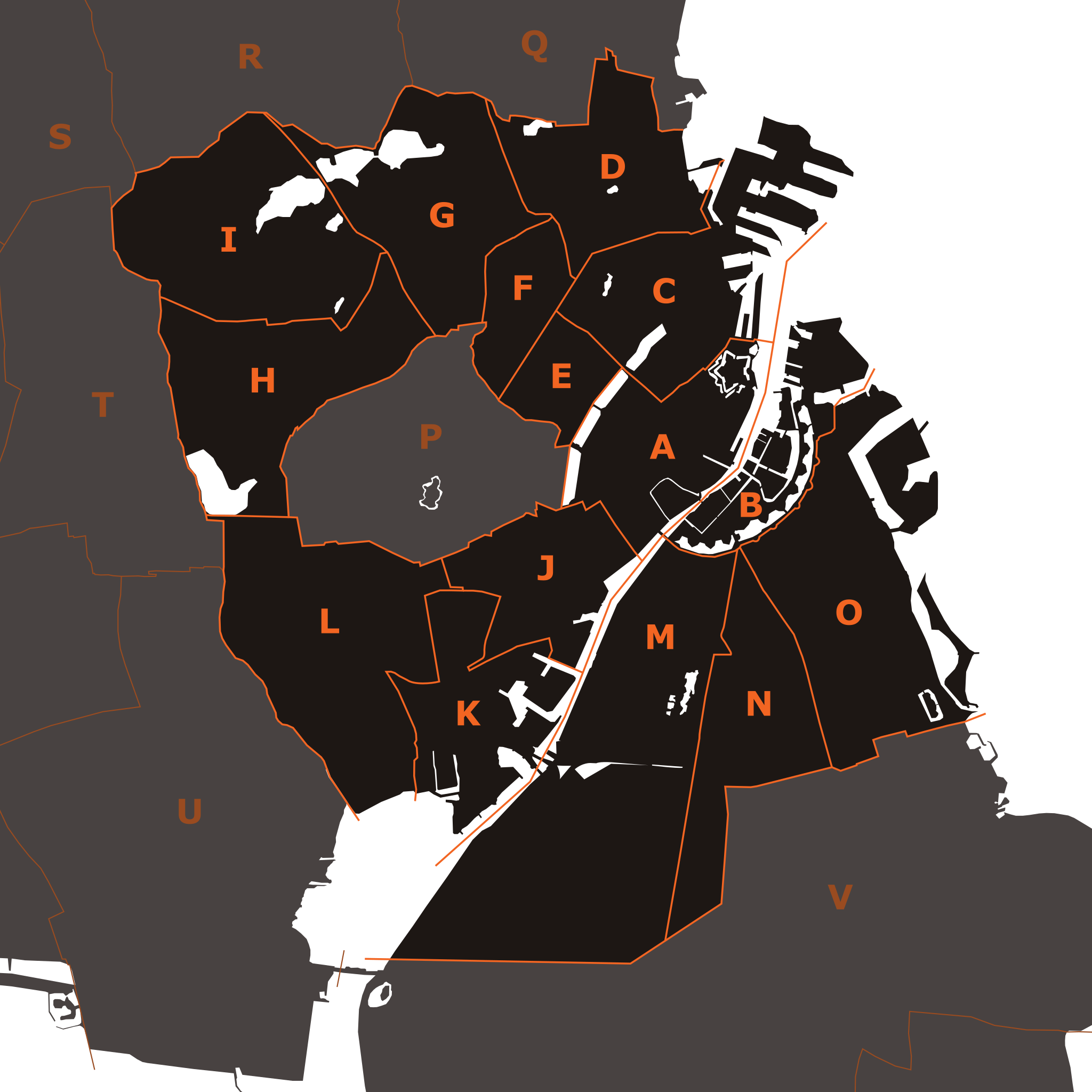
English: Districts of Copenhagen municipality (1 January 2002 — 31 December 2006) — the borders of the districts were based primarily on - Bydels kort (Københavns Kommune) and detailed maps of the surrounding municipalities. The 15 administrative, statistical and tax districts (bydele) are:
The surrounding municipalities are: |
|||
| ⧼wm-license-information-date⧽ | 2008 | |||
| ⧼wm-license-information-source⧽ | ⧼Wm-license-own-work⧽ | |||
| ⧼wm-license-information-author⧽ | Vectorised by Froztbyte | |||
| ⧼wm-license-information-permission⧽ (⧼wm-license-information-permission-reusing-text⧽) |
|
تاريخ الملف
اضغط على زمن/تاريخ لرؤية الملف كما بدا في هذا الزمن.
| زمن/تاريخ | صورة مصغرة | الأبعاد | مستخدم | تعليق | |
|---|---|---|---|---|---|
| حالي | ★ مراجعة معتمدة 13:28، 21 أكتوبر 2023 | | 870 × 870 (49 كيلوبايت) | Pastakhov (نقاش | مساهمات) | Upload https://upload.wikimedia.org/wikipedia/commons/8/82/Districts_of_Copenhagen_municipality_2002-2006.svg |
لا يمكنك استبدال هذا الملف.
وصلات
لا يوجد صفحات تصل لهذه الصورة.