ملف:Digitales Orthofoto von Lichtenberg (Bayerische Vermessungsverwaltung).tif

حجم معاينة PNG لذلك الملف ذي الامتداد TIF: 500 × 600 بكسل. البعد الآخر: 1٬707 × 2٬048 بكسل.
الملف الأصلي (12٬500 × 15٬000 بكسل حجم الملف: 536٫53 ميجابايت، نوع MIME: image/tiff)
وصف قصير
| ⧼wm-license-information-description⧽ |
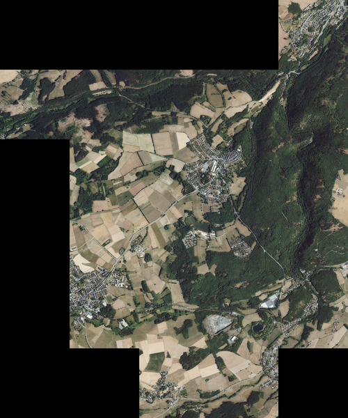
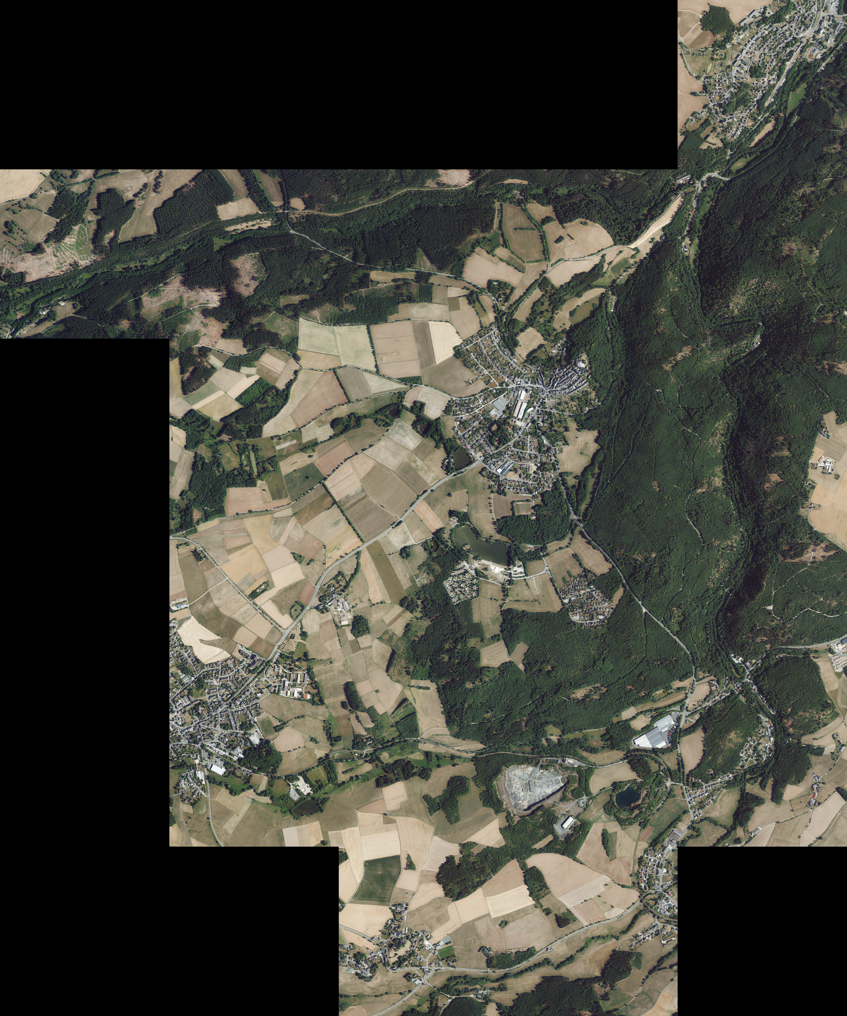
Deutsch: Digitales Orthofoto von Lichtenberg in Oberfranken. Die Kacheln decken die gesamte Fläche der Gemeinde ab.
English: Digital orthophoto of Lichtenberg in Upper Franconia. The tiles cover the entire area of the municipality.
|
| ⧼wm-license-information-date⧽ | قالب:Otherdate |
| ⧼wm-license-information-source⧽ |
|
| ⧼wm-license-information-author⧽ |
|
50°23′N 11°41′E / 50.38°N 11.68°E
ترخيص
تاريخ الملف
اضغط على زمن/تاريخ لرؤية الملف كما بدا في هذا الزمن.
| زمن/تاريخ | صورة مصغرة | الأبعاد | مستخدم | تعليق | |
|---|---|---|---|---|---|
| حالي | ★ مراجعة معتمدة 02:38، 2 ديسمبر 2023 |  | 12٬500 × 15٬000 (536٫53 ميجابايت) | Pastakhov (نقاش | مساهمات) | Upload https://upload.wikimedia.org/wikipedia/commons/8/89/Digitales_Orthofoto_von_Lichtenberg_%28Bayerische_Vermessungsverwaltung%29.tif |
لا يمكنك استبدال هذا الملف.
وصلات
لا يوجد صفحات تصل لهذه الصورة.