ملف:Derbent Khanate.png
حجم هذه المعاينة: 600 × 600 بكسل. البعدان الآخران: 2٬048 × 2٬048 بكسل | 2٬600 × 2٬600 بكسل.
الملف الأصلي (2٬600 × 2٬600 بكسل حجم الملف: 827 كيلوبايت، نوع MIME: image/png)
وصف قصير
| ⧼wm-license-information-description⧽ |
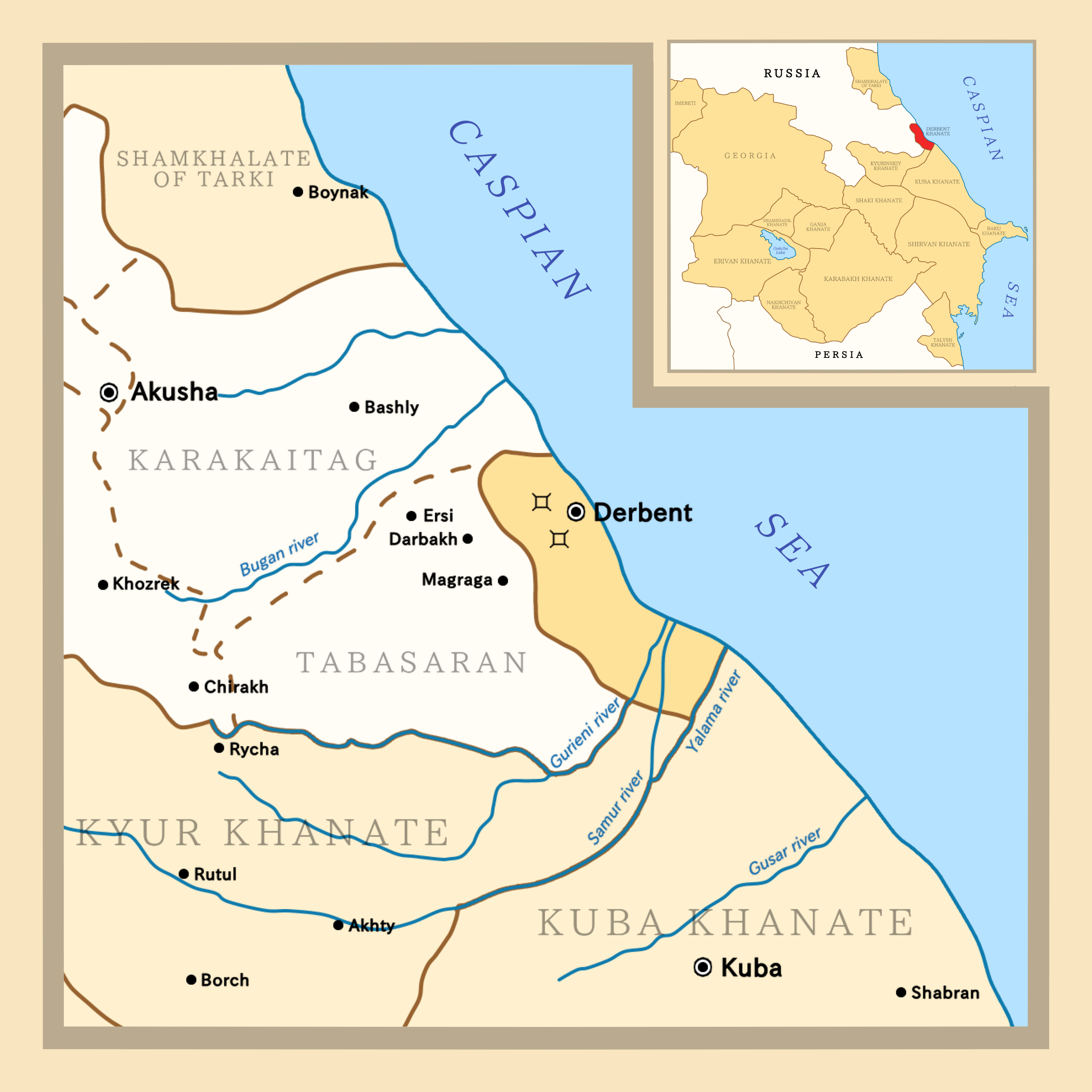
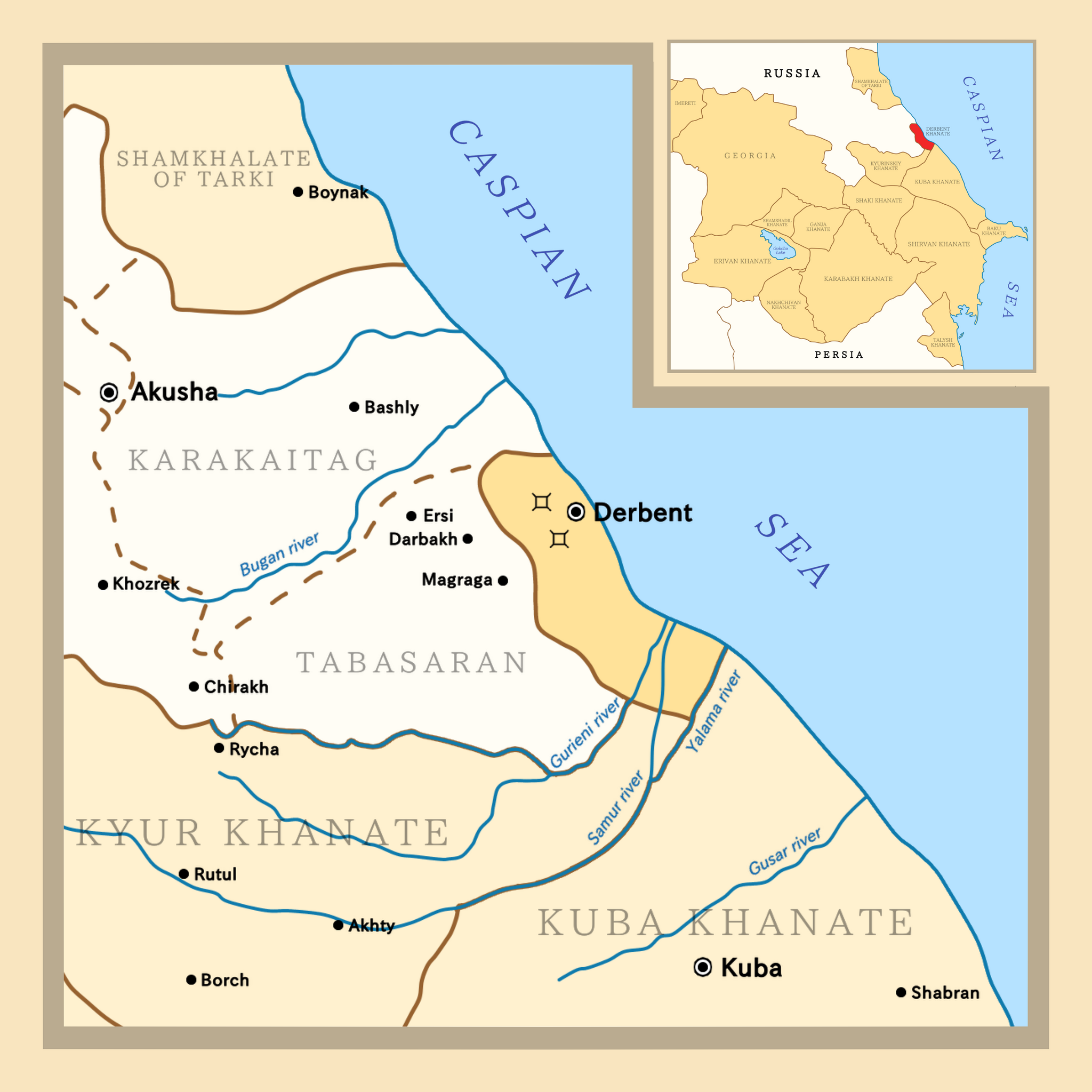
English: Map depicting Derbent Khanate, its surrounding territories and a smaller map on top-right showing location of the khanate in a greater scale
|
| ⧼wm-license-information-date⧽ | 2020 |
| ⧼wm-license-information-source⧽ | Borders adapted from this map and this map |
| ⧼wm-license-information-author⧽ | Golden |
ترخيص
|
تاريخ الملف
اضغط على زمن/تاريخ لرؤية الملف كما بدا في هذا الزمن.
| زمن/تاريخ | صورة مصغرة | الأبعاد | مستخدم | تعليق | |
|---|---|---|---|---|---|
| حالي | ★ مراجعة معتمدة 04:05، 20 أكتوبر 2023 | | 2٬600 × 2٬600 (827 كيلوبايت) | Pastakhov (نقاش | مساهمات) | Upload https://upload.wikimedia.org/wikipedia/commons/4/42/Derbent_Khanate.png |
لا يمكنك استبدال هذا الملف.
وصلات
لا يوجد صفحات تصل لهذه الصورة.