ملف:Dee Wright Observatory (Deschutes County, Oregon scenic images) (desDB1726).jpg

لا توجد دقة أعلى متوفرة.
Dee_Wright_Observatory_(Deschutes_County,_Oregon_scenic_images)_(desDB1726).jpg (488 × 324 بكسل حجم الملف: 68 كيلوبايت، نوع MIME: image/jpeg)
| ⧼wm-license-information-description⧽ |
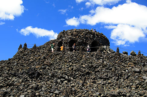
English: Tourists take in the mountain panorama from the Dee Wright Observatory in the lava fields on the McKenzie Highway 242.
|
| ⧼wm-license-information-date⧽ | 2011 |
| ⧼wm-license-information-source⧽ | |
| ⧼wm-license-information-author⧽ | English: Gary Halvorson, Oregon State Archives |
| ⧼wm-license-information-permission⧽ (⧼wm-license-information-permission-reusing-text⧽) |
|
| Photo No. | desDB1726 |
| Camera | Nikon D7000 Digital SLR |
| Lens | Nikon AF-S DX Nikkor 18-200mm F/3.5-5.6G ED VR II |
| Dimensions | 4916 x 3264 pixels (300 dpi version) Available for purchase from the Oregon State Archives. |
| Keywords |
English: horizontal, Oregon, Deschutes County, Cascade Mountains, Dee Wright Observatory, geology, lava, lava field, McKenzie Highway, Highway 242, clouds, blue sky, viewpoint, overlook, people |
تاريخ الملف
اضغط على زمن/تاريخ لرؤية الملف كما بدا في هذا الزمن.
| زمن/تاريخ | صورة مصغرة | الأبعاد | مستخدم | تعليق | |
|---|---|---|---|---|---|
| حالي | ★ مراجعة معتمدة 01:25، 29 نوفمبر 2023 | | 488 × 324 (68 كيلوبايت) | Pastakhov (نقاش | مساهمات) | Upload https://upload.wikimedia.org/wikipedia/commons/3/38/Dee_Wright_Observatory_%28Deschutes_County%2C_Oregon_scenic_images%29_%28desDB1726%29.jpg |
لا يمكنك استبدال هذا الملف.
وصلات
لا يوجد صفحات تصل لهذه الصورة.
_(desDB1726).jpg&oldid=3621649)