ملف:Deception Islands - Whalers Bay.jpg
حجم هذه المعاينة: 800 × 531 بكسل. البعد الآخر: 2٬168 × 1٬440 بكسل.
الملف الأصلي (2٬168 × 1٬440 بكسل حجم الملف: 1٫47 ميجابايت، نوع MIME: image/jpeg)
وصف قصير
| ⧼wm-license-information-description⧽ |
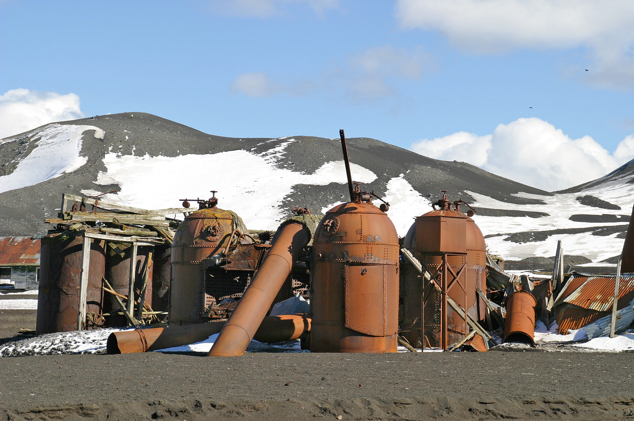
Deutsch: Rostzerfressenen Maschinen und Öfen der ehemals südlichsten Walfangstation der Welt. Die britische Station wurde von 1910 bis 1931 an der Whalers-Bay von Deception Island (Antarktis, Bransfielstraße) betrieben. Deception Island ist eine der größten Kraterinseln der Welt.
English: Rust-eaten machines and stoves of the former southernmost whaling station in the world. The British station was operated from 1910 to 1931 on the Whalers Bay of Deception Island (Antarctic, Bransfielstraße). Deception Island is one of the largest crater islands in the world.
|
| ⧼wm-license-information-date⧽ | 2005, {{time}} – invalid date format 54 (help) |
| ⧼wm-license-information-source⧽ | ⧼Wm-license-own-work⧽ |
| ⧼wm-license-information-author⧽ | W. Bulach |
62°58′45″S 60°33′27″W / 62.979131°S 60.557375°W
ترخيص
|
تاريخ الملف
اضغط على زمن/تاريخ لرؤية الملف كما بدا في هذا الزمن.
| زمن/تاريخ | صورة مصغرة | الأبعاد | مستخدم | تعليق | |
|---|---|---|---|---|---|
| حالي | ★ مراجعة معتمدة 22:15، 21 أكتوبر 2023 | | 2٬168 × 1٬440 (1٫47 ميجابايت) | Pastakhov (نقاش | مساهمات) | Upload https://upload.wikimedia.org/wikipedia/commons/0/09/Deception_Islands_-_Whalers_Bay.jpg |
لا يمكنك استبدال هذا الملف.
وصلات
لا يوجد صفحات تصل لهذه الصورة.