ملف:Dalmatia (Kotor).svg

حجم معاينة PNG لذلك الملف ذي الامتداد SVG: 619 × 599 بكسل. البعد الآخر: 2٬115 × 2٬048 بكسل.
الملف الأصلي (ملف SVG، أبعاده 1٬098 × 1٬063 بكسل، حجم الملف: 800 كيلوبايت)
وصف قصير
| ⧼wm-license-information-description⧽ |
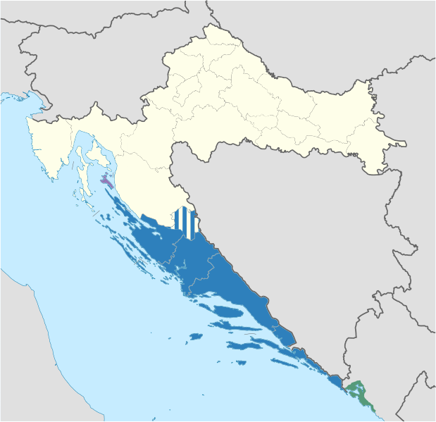
English: The region of Dalmatia on a map of Croatia (with the Kotor Bay area included)
|
| ⧼wm-license-information-date⧽ | 2012 |
| ⧼wm-license-information-source⧽ | ⧼Wm-license-own-work⧽ using File:Croatia location map.svg by NordNordWest |
| ⧼wm-license-information-author⧽ | DIREKTOR |
| ⧼wm-license-information-other-versions⧽ |
ملف:Dalmatia (Various).svg ملف:Dalmatia.svg ملف:Dalmatia (Kingdom).svg ملف:Dalmatia (Counties).svg |
.svg)
.svg)
.svg)
ترخيص
|
تاريخ الملف
اضغط على زمن/تاريخ لرؤية الملف كما بدا في هذا الزمن.
| زمن/تاريخ | صورة مصغرة | الأبعاد | مستخدم | تعليق | |
|---|---|---|---|---|---|
| حالي | ★ مراجعة معتمدة 07:47، 7 نوفمبر 2023 | | 1٬098 × 1٬063 (800 كيلوبايت) | Pastakhov (نقاش | مساهمات) | Upload https://upload.wikimedia.org/wikipedia/commons/7/7d/Dalmatia_%28Kotor%29.svg |
لا يمكنك استبدال هذا الملف.
وصلات
لا يوجد صفحات تصل لهذه الصورة.
.svg&oldid=3404613)