ملف:Cwmystwyth-by-Nigel-Brown.jpg
حجم هذه المعاينة: 800 × 535 بكسل. البعد الآخر: 1٬024 × 685 بكسل.
الملف الأصلي (1٬024 × 685 بكسل حجم الملف: 928 كيلوبايت، نوع MIME: image/jpeg)
| ⧼wm-license-information-description⧽ |
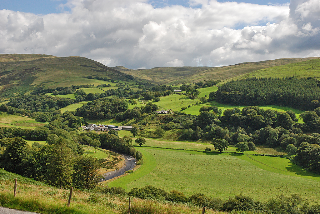
English: A view of Cwmystwyth looking across the only significant flat area of the cwm to be found before the river reaches maturity near Trawscoed some 6 miles further west. Beyond, steep slopes rise to the Elenydd moors. Opposite is the cwm of the Nant Milwyn, at the head of which is the small but distinctive hill of Domen Milwyn.
|
| ⧼wm-license-information-date⧽ | 2008 |
| ⧼wm-license-information-source⧽ | From geograph.org.uk |
| ⧼wm-license-information-author⧽ | Nigel Brown |
| ⧼wm-license-information-permission⧽ (⧼wm-license-information-permission-reusing-text⧽) |
تاريخ الملف
اضغط على زمن/تاريخ لرؤية الملف كما بدا في هذا الزمن.
| زمن/تاريخ | صورة مصغرة | الأبعاد | مستخدم | تعليق | |
|---|---|---|---|---|---|
| حالي | ★ مراجعة معتمدة 16:37، 8 نوفمبر 2023 | | 1٬024 × 685 (928 كيلوبايت) | Pastakhov (نقاش | مساهمات) | Upload https://upload.wikimedia.org/wikipedia/commons/d/d7/Cwmystwyth-by-Nigel-Brown.jpg |
لا يمكنك استبدال هذا الملف.
وصلات
لا يوجد صفحات تصل لهذه الصورة.