ملف:Crimea crisis map.PNG

حجم هذه المعاينة: 720 × 600 بكسل. البعد الآخر: 1٬200 × 1٬000 بكسل.
الملف الأصلي (1٬200 × 1٬000 بكسل حجم الملف: 61 كيلوبايت، نوع MIME: image/png)
وصف قصير
| ⧼wm-license-information-description⧽ |
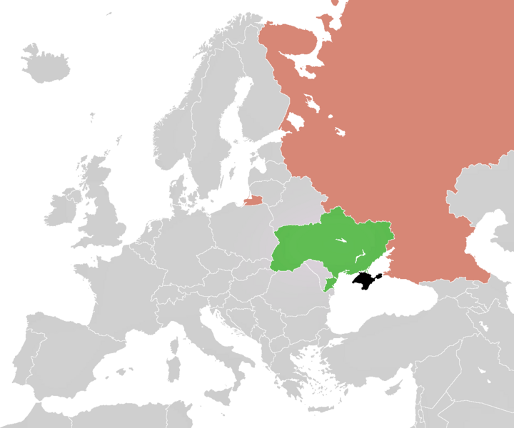
English: Map of the 2014 Crimean Crisis. The Crimean peninsula is shown in black as its territory is disputed between claimants (as of writing the Crimean government and the Ukrainian government, but almost certainly by the Russian government in a short matter of time). Outside of the disputed territory of the Crimean peninsula shown in black are Ukraine in green and Russia in a red-like hue.
|
| ⧼wm-license-information-date⧽ | 2014, {{time}} – invalid date format 51 (help) |
| ⧼wm-license-information-source⧽ | ⧼Wm-license-own-work⧽ |
| ⧼wm-license-information-author⧽ | ImageUploader12345 |
| ⧼wm-license-information-other-versions⧽ |
ملف:LocationCrimea 4.PNG ملف:LocationCrimea 5.png ملف:Location UK-Crimea-RU.PNG ملف:Crimea crisis map (alternate color for Russia).PNG |
.PNG)
ترخيص
|
تاريخ الملف
اضغط على زمن/تاريخ لرؤية الملف كما بدا في هذا الزمن.
| زمن/تاريخ | صورة مصغرة | الأبعاد | مستخدم | تعليق | |
|---|---|---|---|---|---|
| حالي | ★ مراجعة معتمدة 01:39، 20 أكتوبر 2023 | | 1٬200 × 1٬000 (61 كيلوبايت) | Pastakhov (نقاش | مساهمات) | Upload https://upload.wikimedia.org/wikipedia/commons/3/33/Crimea_crisis_map.PNG |
لا يمكنك استبدال هذا الملف.
وصلات
لا يوجد صفحات تصل لهذه الصورة.